|
search place name
|
||
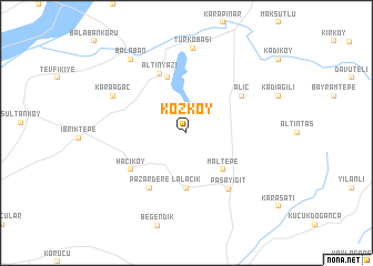
Kozköy (Edirne, Turkey)Kozköy is a town in the Edirne region of Turkey. An overview map of the region around Kozköy is displayed below.
regional and 3d topo map of Kozköy, Turkey ::
Kozköy airports ::
The nearest airport is AXD - Alexandroupolis Dimokritos, located 57.1 km west of Kozköy.
Other airports nearby include BDM - Bandirma (140.0 km south east), KVA - Kavala Megas Alexandros Intl (167.1 km west), LXS - Limnos (168.2 km south west), PDV - Plovdiv (186.9 km north west), Nearby towns ::
Maltepe (4.6km south east) //
Lalacık (5.6km south) //
Harala (5.7km north) //
Altınyazı (6.3km north) //
Alıç (5.6km north east) //
Pazardere (6.2km south west) //
Hacıköy (5.6km south west) //
Paşayiğit (6.5km south east) //
Karaağaç (6.7km north west) //
Türkobası (8.5km north) //
Balaban (8.5km north west) //
[all distances 'as the bird flies' and approximate] 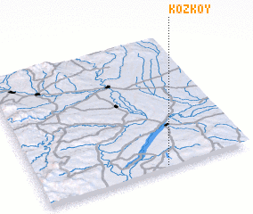 Places with similar names to Kozköy, Turkey ::
Disclaimer :: Information on this page comes without warranty of any kind |
||
|
Where is Kozköy? Elevation and coordinates ::
Latitude (lat): 41°1'0"N Longitude (lon): 26°36'0"E
Elevation (approx.): 55m (map arrows pan, magnifying glasses zoom) |
||
|
Visiting Kozköy? Hotel/Accommodation ::
Book a hotel in Kozköy Travel Guide ::
Buy a travel guide for Turkey rental cars ::
car rental offers GPS waypoint ::
download a GPX waypoint (PoI) of Kozköy for your GPS receiver
|
||