|
search place name
|
||
Mantarlı (Şanlıurfa, Turkey)Mantarlı is a town in the Şanlıurfa region of Turkey. An overview map of the region around Mantarlı is displayed below.
regional and 3d topo map of Mantarlı, Turkey ::

Mantarlı airports ::
The nearest airport is DIY - Diyabakir Diyarbakir, located 101.7 km north east of Mantarlı.
Other airports nearby include EZS - Elazig (121.7 km north), MLX - Malatya Erhac (138.0 km north west), GZT - Gaziantep Oguzeli (161.2 km south west), BAL - Batman (179.3 km east), Nearby towns ::
Arınık (2.9km west) //
Saruhan (3.7km north) //
Gölebakan (4.7km south west) //
Akıncak (5.6km south) //
Doğrular (6.3km north west) //
Kuskunlu (6.3km south east) //
Saluca (6.2km east) //
Bölükbaşı (7.9km north east) //
Güllüce (8.0km north) //
Çöze (8.1km north east) //
Dorumali (8.6km south east) //
Ayazca (8.1km south east) //
[all distances 'as the bird flies' and approximate] 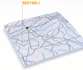 Places with similar names to Mantarlı, Turkey ::
// Montreal (US)
// Montreal (US)
// Munderloh (DE)
// Mandriole (IT)
// Monte Real (PT)
// Monteril (ES)
// Minderla (RU)
// Mount Aerial (US)
// Montreal (US)
// Montreal (BS)
Disclaimer :: Information on this page comes without warranty of any kind |
||
|
Where is Mantarlı? Elevation and coordinates ::
Latitude (lat): 37°31'0"N Longitude (lon): 39°9'0"E
Elevation (approx.): 665m (map arrows pan, magnifying glasses zoom) |
||
|
Visiting Mantarlı? Hotel/Accommodation ::
Book a hotel in Mantarlı Travel Guide ::
Buy a travel guide for Turkey rental cars ::
car rental offers GPS waypoint ::
download a GPX waypoint (PoI) of Mantarlı for your GPS receiver
|
||