|
search place name
|
||
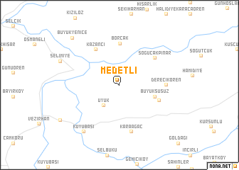
Medetli (Bilecik, Turkey)Medetli is a town in the Bilecik region of Turkey. An overview map of the region around Medetli is displayed below.
regional and 3d topo map of Medetli, Turkey ::
Medetli airports ::
The nearest airport is ESK - Eskisehir, located 68.9 km south east of Medetli.
Other airports nearby include IST - Istanbul Ataturk (134.5 km north west), AFY - Afyon (179.3 km south), Nearby towns ::
Üyük (3.8km south west) //
Büyüksusuz (4.6km south east) //
Borcak (6.5km north) //
Kazancı (6.2km north west) //
Küçüksusuz (5.4km south east) //
Soğucakpınar (6.0km north east) //
Derecikören (5.7km east) //
Karaağaç (7.5km south) //
Kuyubaşı (8.5km south west) //
Büyükyenice (9.3km north west) //
[all distances 'as the bird flies' and approximate]  Places with similar names to Medetli, Turkey ::
// Mawtawtale (MM)
// Meadowdale (US)
// Matatal (PH)
// Madutle (ZA)
// Matatiela (ZA)
// Matatiele (ZA)
// Meadedale (US)
// Mattydale (US)
// Meadowdale (US)
// Meadowdale (US)
Disclaimer :: Information on this page comes without warranty of any kind |
||
|
Where is Medetli? Elevation and coordinates ::
Latitude (lat): 40°18'0"N Longitude (lon): 30°8'0"E
Elevation (approx.): 367m (map arrows pan, magnifying glasses zoom) |
||
|
Visiting Medetli? Hotel/Accommodation ::
Book a hotel in Medetli Travel Guide ::
Buy a travel guide for Turkey rental cars ::
car rental offers GPS waypoint ::
download a GPX waypoint (PoI) of Medetli for your GPS receiver
|
||