|
search place name
|
||
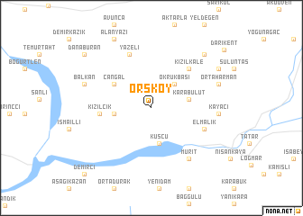
Örsköy (Tunceli, Turkey)Örsköy is a town in the Tunceli region of Turkey. An overview map of the region around Örsköy is displayed below.
regional and 3d topo map of Örsköy, Turkey ::
Örsköy airports ::
The nearest airport is EZS - Elazig, located 50.3 km south west of Örsköy.
Other airports nearby include ERC - Erzincan (90.8 km north), DIY - Diyabakir Diyarbakir (119.9 km south), MLX - Malatya Erhac (151.5 km west), BAL - Batman (162.9 km south east), Nearby towns ::
Okrukbaşı (3.7km north east) //
Kuşçu (4.5km south) //
Güneşdere (3.7km west) //
Karabulut (3.8km east) //
Çangal (4.6km north west) //
Kızılcık (5.1km west) //
Kızılkale (6.0km north east) //
Elmalık (5.7km south east) //
Yazeli (7.0km north) //
Mürit (7.3km south east) //
Kayacı (6.6km east) //
Balkan (7.1km north west) //
Ortaharman (7.2km north east) //
Çatköy (8.4km north east) //
Özdek (8.1km north east) //
Alanyazı (9.2km north west) //
Danaburan (9.3km north west) //
Demirci (10.4km south west) //
[all distances 'as the bird flies' and approximate]  Places with similar names to Örsköy, Turkey ::
Disclaimer :: Information on this page comes without warranty of any kind |
||
|
Where is Örsköy? Elevation and coordinates ::
Latitude (lat): 38°54'24"N Longitude (lon): 39°43'29"E
Elevation (approx.): 1130m (map arrows pan, magnifying glasses zoom) |
||
|
Visiting Örsköy? Hotel/Accommodation ::
Book a hotel in Örsköy Travel Guide ::
Buy a travel guide for Turkey rental cars ::
car rental offers GPS waypoint ::
download a GPX waypoint (PoI) of Örsköy for your GPS receiver
|
||