|
search place name
|
||
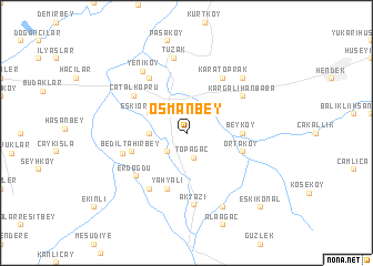
Osmanbey (Sakarya, Turkey)Osmanbey is a town in the Sakarya region of Turkey. An overview map of the region around Osmanbey is displayed below.
regional and 3d topo map of Osmanbey, Turkey ::
Osmanbey airports ::
The nearest airport is ESK - Eskisehir, located 107.3 km south of Osmanbey.
Other airports nearby include IST - Istanbul Ataturk (154.0 km west), Nearby towns ::
Topağaç (2.5km south) //
Yeniormanköy (2.3km north west) //
Vakıf (2.3km south west) //
Kızılcıkorman (2.8km west) //
Eskiormanköy (3.4km north west) //
Beyköy (4.2km east) //
Yahyalı (5.7km south) //
Bediltahirbey (4.6km south west) //
Ortaköy (4.6km south east) //
Çatalköprü (5.5km north west) //
Beditkadirbey (5.2km west) //
Karatoprak (6.2km north east) //
Kargalıhanbaba (5.6km north east) //
Kabakulak (6.2km south west) //
Sukenarı (6.2km north west) //
Erdoğdu (5.8km south west) //
Akyazı (7.2km south) //
Yeniköy (7.0km north west) //
Tuzak (7.6km north) //
Şeyhler (7.0km north east) //
Yağcılar (7.9km south) //
Eskikonal (9.3km south east) //
[all distances 'as the bird flies' and approximate] 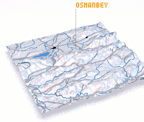 Places with similar names to Osmanbey, Turkey ::
// Osmanbey (TR)
Disclaimer :: Information on this page comes without warranty of any kind |
||
|
Where is Osmanbey? Elevation and coordinates ::
Latitude (lat): 40°45'0"N Longitude (lon): 30°37'0"E
Elevation (approx.): 31m (map arrows pan, magnifying glasses zoom) |
||
|
Visiting Osmanbey? Hotel/Accommodation ::
Book a hotel in Osmanbey Travel Guide ::
Buy a travel guide for Turkey rental cars ::
car rental offers GPS waypoint ::
download a GPX waypoint (PoI) of Osmanbey for your GPS receiver
|
||