|
search place name
|
||
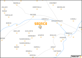
Sağrıca (Ağrı, Turkey)Sağrıca is a town in the Ağrı region of Turkey. An overview map of the region around Sağrıca is displayed below.
regional and 3d topo map of Sağrıca, Turkey ::
Sağrıca airports ::
The nearest airport is VAN - Van, located 87.8 km south east of Sağrıca.
Other airports nearby include ERZ - Erzurum (171.6 km north west), BAL - Batman (208.7 km south west), Nearby towns ::
Uzunca (3.7km south) //
Çamurlu (4.0km north) //
Kanakbey (5.2km south west) //
Kızılkaya (4.7km south west) //
Akdilek (5.7km south east) //
Patnos (6.4km north west) //
Değirmendüzü (6.4km north east) //
Yukarıkamışlı (8.0km south west) //
Yukarıkamışlı (9.4km south west) //
[all distances 'as the bird flies' and approximate] 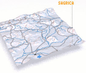 Places with similar names to Sağrıca, Turkey ::
// Segraga (MA)
// Şükürçü (AZ)
// Zagorka (RU)
// Zagorok (RU)
// Zui-Gorka (RU)
// Schaueregg (AT)
// Schaueregg (AT)
// Schrick (AT)
// Schröck (AT)
// Scheuereck (DE)
Disclaimer :: Information on this page comes without warranty of any kind |
||
|
Where is Sağrıca? Elevation and coordinates ::
Latitude (lat): 39°11'0"N Longitude (lon): 42°54'0"E
Elevation (approx.): 1801m (map arrows pan, magnifying glasses zoom) |
||
|
Visiting Sağrıca? Hotel/Accommodation ::
Book a hotel in Sağrıca Travel Guide ::
Buy a travel guide for Turkey rental cars ::
car rental offers GPS waypoint ::
download a GPX waypoint (PoI) of Sağrıca for your GPS receiver
|
||