|
search place name
|
||
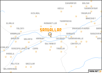
Sandallar (Bolu, Turkey)Sandallar is a town in the Bolu region of Turkey. An overview map of the region around Sandallar is displayed below.
regional and 3d topo map of Sandallar, Turkey ::
Sandallar airports ::
The nearest airport is ANK - Ankara Etimesgut, located 126.8 km south east of Sandallar.
Other airports nearby include ESK - Eskisehir (134.1 km south west), ESB - Ankara Esenboga (136.5 km south east), AFY - Afyon (236.5 km south), Nearby towns ::
Kasaplar (0.0km north) //
Bolu (2.9km north east) //
Alpagut (3.7km north) //
Pirahmetler (3.7km north) //
Sultanbey (3.7km south) //
Çivril (3.2km north west) //
Karaköy (3.4km south west) //
Çayırköy (3.4km south east) //
Sultanköy (4.9km south) //
Karamanlar (4.7km north west) //
Karacasu (4.7km south east) //
Okçular (4.2km east) //
Taşoluk (6.2km south east) //
Yukarısoku (6.2km north east) //
Ovadüzü (5.6km east) //
Çepni (7.0km south west) //
Gölköyü (6.6km west) //
Kızılağıl (8.5km north west) //
[all distances 'as the bird flies' and approximate] 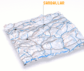 Places with similar names to Sandallar, Turkey ::
// Santa Laura (BR)
// Santa Luria (IT)
// Sandallar (TR)
// Santa Olaria (ES)
// Sandlaer (ZA)
// Santa Laura (MX)
// Santa Laura (PE)
// Saint-Aulaire (FR)
// Saint-Élier (FR)
// Saint-Lary (FR)
Disclaimer :: Information on this page comes without warranty of any kind |
||
|
Where is Sandallar? Elevation and coordinates ::
Latitude (lat): 40°43'0"N Longitude (lon): 31°35'0"E
Elevation (approx.): 721m (map arrows pan, magnifying glasses zoom) |
||
|
Visiting Sandallar? Hotel/Accommodation ::
Book a hotel in Sandallar Travel Guide ::
Buy a travel guide for Turkey rental cars ::
car rental offers GPS waypoint ::
download a GPX waypoint (PoI) of Sandallar for your GPS receiver
|
||