|
search place name
|
||
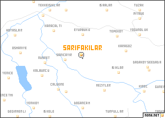
Sarıfakılar (Balıkesir, Turkey)Sarıfakılar is a town in the Balıkesir region of Turkey. An overview map of the region around Sarıfakılar is displayed below.
regional and 3d topo map of Sarıfakılar, Turkey ::
Sarıfakılar airports ::
The nearest airport is BZI - Balikesir, located 26.5 km west of Sarıfakılar.
Other airports nearby include BDM - Bandirma (82.7 km north), MJT - Mytilini Mitilini (153.3 km south west), IGL - Izmir Cigli (160.5 km south west), IST - Istanbul Ataturk (160.7 km north), Nearby towns ::
Sarıçayır (3.0km west) //
Eyüpbükü (5.6km north) //
Dereçerkez see Çaldere (7.9km south) //
Nusret (6.6km west) //
Mezitler (8.1km south east) //
Işıklar (7.0km south east) //
Çaldere (8.1km south west) //
Karaçaltı (8.2km north west) //
Tepeköy (8.0km north east) //
[all distances 'as the bird flies' and approximate] 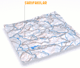 Places with similar names to Sarıfakılar, Turkey :: Disclaimer :: Information on this page comes without warranty of any kind |
||
|
Where is Sarıfakılar? Elevation and coordinates ::
Latitude (lat): 39°36'0"N Longitude (lon): 28°14'0"E
Elevation (approx.): 385m (map arrows pan, magnifying glasses zoom) |
||
|
Visiting Sarıfakılar? Hotel/Accommodation ::
Book a hotel in Sarıfakılar Travel Guide ::
Buy a travel guide for Turkey rental cars ::
car rental offers GPS waypoint ::
download a GPX waypoint (PoI) of Sarıfakılar for your GPS receiver
|
||