|
search place name
|
||
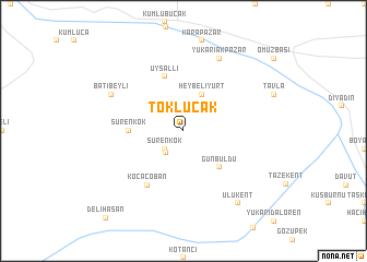
Toklucak (Ağrı, Turkey)Toklucak is a town in the Ağrı region of Turkey. An overview map of the region around Toklucak is displayed below.
regional and 3d topo map of Toklucak, Turkey ::
Toklucak airports ::
The nearest airport is VAN - Van, located 117.7 km south of Toklucak.
Nearby towns ::
Sürenkök (2.3km south west) //
Sürmelikoç (2.7km south west) //
Heybeliyurt (4.0km north) //
Günbuldu (4.7km south east) //
Sürenkök (4.3km west) //
Uysallı (5.7km north) //
Kocaçoban (6.3km south west) //
Batıbeyli (6.8km north west) //
Yukarıakpazar (7.9km north) //
Ulukent (8.6km south east) //
Delihasan (10.8km south west) //
[all distances 'as the bird flies' and approximate] 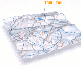
Disclaimer :: Information on this page comes without warranty of any kind |
||
|
Where is Toklucak? Elevation and coordinates ::
Latitude (lat): 39°31'0"N Longitude (lon): 43°32'0"E
Elevation (approx.): 2089m (map arrows pan, magnifying glasses zoom) |
||
|
Visiting Toklucak? Hotel/Accommodation ::
Book a hotel in Toklucak Travel Guide ::
Buy a travel guide for Turkey rental cars ::
car rental offers GPS waypoint ::
download a GPX waypoint (PoI) of Toklucak for your GPS receiver
|
||