|
search place name
|
||
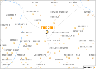
Turanlı (Kilis, Turkey)Turanlı is a town in the Kilis region of Turkey. An overview map of the region around Turanlı is displayed below.
regional and 3d topo map of Turanlı, Turkey ::
Turanlı airports ::
The nearest airport is GZT - Gaziantep Oguzeli, located 27.6 km north of Turanlı.
Other airports nearby include ALP - Aleppo Intl (61.7 km south), LTK - Latakia Bassel Al Assad Intl (199.1 km south west), MLX - Malatya Erhac (200.3 km north), EZS - Elazig (265.6 km north east), Nearby towns ::
Elbeyli (2.8km south) //
Mullā Ya‘qūb (4.1km south east) //
Silsilah (3.9km south east) //
Selmincik (4.7km north) //
Aşağıbeylerbeyi (4.0km east) //
‘Ayyāsh (5.0km south east) //
Alahan (5.1km south west) //
Günece (5.4km north west) //
Arslanlı (6.1km north) //
Çobanbey (6.8km south) //
Kirsanlī (6.2km south east) //
Būzlījah ash Sharqīyah (7.5km south) //
Thaljah Sharqīyah (7.4km south east) //
Tilkip (8.0km north) //
Taşlıbakar (6.6km west) //
Al Khalīlīyah (6.8km east) //
Büyükkaracaören (8.4km north east) //
Büyükbıyık (7.9km south west) //
Çıldıroba (8.3km south west) //
Yenideğirmen (9.2km north west) //
Al Muthminah (10.5km south east) //
[all distances 'as the bird flies' and approximate] 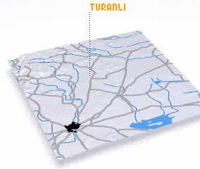 Places with similar names to Turanlı, Turkey ::
Disclaimer :: Information on this page comes without warranty of any kind |
||
|
Where is Turanlı? Elevation and coordinates ::
Latitude (lat): 36°41'53"N Longitude (lon): 37°28'35"E
Elevation (approx.): 533m (map arrows pan, magnifying glasses zoom) |
||
|
Visiting Turanlı? Hotel/Accommodation ::
Book a hotel in Turanlı Travel Guide ::
Buy a travel guide for Turkey rental cars ::
car rental offers GPS waypoint ::
download a GPX waypoint (PoI) of Turanlı for your GPS receiver
|
||