|
search place name
|
||
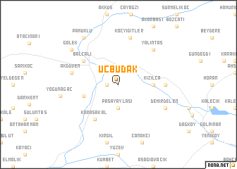
Üçbudak (Elazığ, Turkey)Üçbudak is a town in the Elazığ region of Turkey. An overview map of the region around Üçbudak is displayed below.
regional and 3d topo map of Üçbudak, Turkey ::
Üçbudak airports ::
The nearest airport is EZS - Elazig, located 70.8 km south west of Üçbudak.
Other airports nearby include ERC - Erzincan (86.3 km north west), DIY - Diyabakir Diyarbakir (125.0 km south), ERZ - Erzurum (150.3 km north east), BAL - Batman (157.5 km south east), Nearby towns ::
Bağın (1.4km west) //
Paşayaylası (3.7km south) //
Kızılca (4.3km east) //
Yaşaroğlu (4.7km south west) //
Karasakal (6.3km south west) //
Balcalı (5.7km north west) //
Hamzalı (5.8km east) //
Akdüven (6.1km west) //
Koçyiğitler (7.6km north) //
Yalıntaş (7.0km north east) //
Demirdelen (6.9km south east) //
Gölek (8.0km north west) //
Pamuklu (8.6km north west) //
[all distances 'as the bird flies' and approximate] 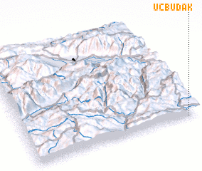 Places with similar names to Üçbudak, Turkey :: Disclaimer :: Information on this page comes without warranty of any kind |
||
|
Where is Üçbudak? Elevation and coordinates ::
Latitude (lat): 39°0'0"N Longitude (lon): 39°56'0"E
Elevation (approx.): 1210m (map arrows pan, magnifying glasses zoom) |
||
|
Visiting Üçbudak? Hotel/Accommodation ::
Book a hotel in Üçbudak Travel Guide ::
Buy a travel guide for Turkey rental cars ::
car rental offers GPS waypoint ::
download a GPX waypoint (PoI) of Üçbudak for your GPS receiver
|
||