|
search place name
|
||
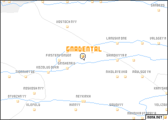
Gnadentalʼ (Ukraine)Gnadentalʼ is a town in Ukraine. An overview map of the region around Gnadentalʼ is displayed below.
regional and 3d topo map of Gnadentalʼ, Ukraine ::
Gnadentalʼ airports ::
The nearest airport is DNK - Dnepropetrovsk Dnipropetrovsk Intl, located 147.7 km north west of Gnadentalʼ.
Other airports nearby include DOK - Donetsk Intl (175.4 km north east), Nearby towns ::
Balashovka (2.2km north east) //
Grishenau (3.1km south west) //
Aleksandervolʼ (3.1km north west) //
Firstenverder (3.8km west) //
Shirokiy Yar (5.0km east) //
Nikolayevka (6.3km south east) //
Landskrone (6.3km north east) //
Vostochnyy (7.8km north) //
Kozolugovka (6.0km south west) //
[all distances 'as the bird flies' and approximate]  Places with similar names to Gnadentalʼ, Ukraine ::
// Gnadental (DE)
// Ndundula (ZA)
// Newtondale (ZA)
// Ntontela (ZA)
// Ndondol (SN)
// Ndandula (ZM)
// Ndondila (ML)
// Newtown Daly (IE)
// Notendaal (NL)
Disclaimer :: Information on this page comes without warranty of any kind |
||
|
Where is Gnadentalʼ? Elevation and coordinates ::
Latitude (lat): 47°8'0"N Longitude (lon): 35°52'0"E
Elevation (approx.): 85m (map arrows pan, magnifying glasses zoom) |
||
|
Visiting Gnadentalʼ? Hotel/Accommodation ::
Book a hotel in Gnadentalʼ Travel Guide ::
Buy a travel guide for Ukraine rental cars ::
car rental offers GPS waypoint ::
download a GPX waypoint (PoI) of Gnadentalʼ for your GPS receiver
|
||