|
search place name
|
||
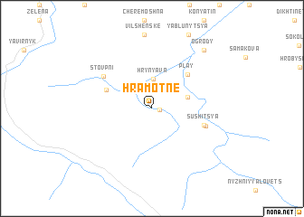
Hramotne (Ukraine)Hramotne is a town in Ukraine. An overview map of the region around Hramotne is displayed below.
regional and 3d topo map of Hramotne, Ukraine ::
Hramotne airports ::
The nearest airport is BAY - Baia Mare Tautii Magheraus, located 110.2 km west of Hramotne.
Other airports nearby include SCV - Suceava Stefan Cel Mare (114.6 km east), SUJ - Satu Mare (151.5 km west), CLJ - Cluj-napoca Cluj Napoca (157.8 km south west), TGM - Tirgu Mures Vidrasau (168.7 km south), Nearby towns ::
Perekhrestne (0.6km east) //
Hrynyava (3.6km north) //
Bila Richka (3.2km north east) //
Play (5.1km north east) //
Probiynivka (4.4km north west) //
Sushitsya (4.8km south east) //
Holoshyna (5.0km south east) //
Stovpni (5.6km north west) //
Ogrody (8.4km north east) //
[all distances 'as the bird flies' and approximate]  Places with similar names to Hramotne, Ukraine ::
// Rām Deni (MM)
// Rumah Dana (MY)
// Rumah Dana (MY)
// Rumah Dana (MY)
// Rumah Dana (MY)
// Rumah Danau (MY)
// Rumah Dian (MY)
// Ramadani (RO)
// Romodan (UA)
// Ramtown (US)
Disclaimer :: Information on this page comes without warranty of any kind |
||
|
Where is Hramotne? Elevation and coordinates ::
Latitude (lat): 47°57'7"N Longitude (lon): 24°52'31"E
Elevation (approx.): 818m (map arrows pan, magnifying glasses zoom) |
||
|
Visiting Hramotne? Hotel/Accommodation ::
Book a hotel in Hramotne Travel Guide ::
Buy a travel guide for Ukraine rental cars ::
car rental offers GPS waypoint ::
download a GPX waypoint (PoI) of Hramotne for your GPS receiver
|
||