|
search place name
|
||
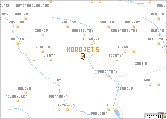
Koropets (Ukraine)Koropets is a town in Ukraine. An overview map of the region around Koropets is displayed below.
regional and 3d topo map of Koropets, Ukraine ::
Koropets airports ::
The nearest airport is LWO - Lvov Lviv Intl, located 68.8 km west of Koropets.
Other airports nearby include SCV - Suceava Stefan Cel Mare (245.3 km south east), SUJ - Satu Mare (263.2 km south west), Nearby towns ::
Ugortse (2.2km north east) //
Podgorʼye (3.9km north) //
Bibshchany (3.9km south) //
Remezovtsy (5.6km north) //
Pomoryany (5.2km south east) //
Vitsynʼ (4.8km west) //
Bogutyn (4.8km east) //
Dunayev (6.6km south west) //
Shpiklosy (7.8km north) //
Snovichi (8.2km north east) //
Plikhov (8.8km south east) //
[all distances 'as the bird flies' and approximate] 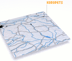 Places with similar names to Koropets, Ukraine ::
// Kriepitz (DE)
// Carapetos (PT)
// Carapetos (PT)
// Carapetos (PT)
// Carapetosa (PT)
// Carrapatas (PT)
// Carrapatosa (PT)
// Carrapatoso (PT)
// Carrapatoso (PT)
// Krapets (BG)
Disclaimer :: Information on this page comes without warranty of any kind |
||
|
Where is Koropets? Elevation and coordinates ::
Latitude (lat): 49°40'0"N Longitude (lon): 24°53'0"E
Elevation (approx.): 340m (map arrows pan, magnifying glasses zoom) |
||
|
Visiting Koropets? Hotel/Accommodation ::
Book a hotel in Koropets Travel Guide ::
Buy a travel guide for Ukraine rental cars ::
car rental offers GPS waypoint ::
download a GPX waypoint (PoI) of Koropets for your GPS receiver
|
||