|
search place name
|
||
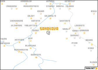
Samakova (Ukraine)Samakova is a town in Ukraine. An overview map of the region around Samakova is displayed below.
regional and 3d topo map of Samakova, Ukraine ::
Samakova airports ::
The nearest airport is SCV - Suceava Stefan Cel Mare, located 109.0 km east of Samakova.
Other airports nearby include BAY - Baia Mare Tautii Magheraus (119.5 km west), CLJ - Cluj-napoca Cluj Napoca (167.5 km south west), TGM - Tirgu Mures Vidrasau (176.7 km south), LWO - Lvov Lviv Intl (214.1 km north), Nearby towns ::
Ogrody (3.5km west) //
Dolgopolʼye (6.4km north) //
Sokoliy (4.6km east) //
Konyatin (5.7km north west) //
Hrobyshche (4.7km east) //
Polyanki (6.7km north) //
Yablunytsya (5.4km north west) //
Play (5.2km south west) //
Dikhtinets (6.1km north east) //
Kyselytsi (6.1km north east) //
Bila Richka (6.9km south west) //
Kokhan (8.5km north) //
Golovy (7.9km north west) //
Holoshyna (9.1km south) //
Sushitsya (9.1km south) //
[all distances 'as the bird flies' and approximate] 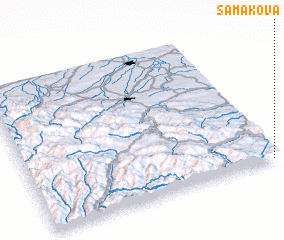 Places with similar names to Samakova, Ukraine ::
// Sumağava (AZ)
// Samokov (BG)
// Sumkova (LV)
// Smykov (UA)
// Sambaokofa (MG)
// Sambaokofa (MG)
// Semokfu (CD)
// Samokov (MK)
// Samakūfah (SY)
// Xóm Cư Phú (VN)
Disclaimer :: Information on this page comes without warranty of any kind |
||
|
Where is Samakova? Elevation and coordinates ::
Latitude (lat): 48°0'33"N Longitude (lon): 24°58'44"E
Elevation (approx.): 841m (map arrows pan, magnifying glasses zoom) |
||
|
Visiting Samakova? Hotel/Accommodation ::
Book a hotel in Samakova Travel Guide ::
Buy a travel guide for Ukraine rental cars ::
car rental offers GPS waypoint ::
download a GPX waypoint (PoI) of Samakova for your GPS receiver
|
||