|
search place name
|
||
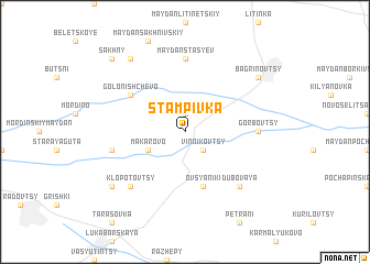
Stampivka (Ukraine)Stampivka is a town in Ukraine. An overview map of the region around Stampivka is displayed below.
regional and 3d topo map of Stampivka, Ukraine ::
Stampivka airports ::
The nearest airport is SCV - Suceava Stefan Cel Mare, located 206.6 km south west of Stampivka.
Nearby towns ::
Maydan Sovin (1.9km north) //
Vinnikovtsy (2.2km south east) //
Makarovo (3.0km south west) //
Ovsyaniki (5.7km south) //
Golonishchevo (5.2km north west) //
Gorbovtsy (4.8km east) //
Maydan Stasʼyev (7.4km north) //
Maydan-Chernelivetskiy (5.2km west) //
Klopotovtsy (6.6km south west) //
Dubovaya (6.6km south east) //
Bagrinovtsy (7.4km north east) //
Chernelivtsy (7.4km south west) //
Lozny (8.3km north west) //
Sakhny (8.9km north west) //
[all distances 'as the bird flies' and approximate]  Places with similar names to Stampivka, Ukraine :: Disclaimer :: Information on this page comes without warranty of any kind |
||
|
Where is Stampivka? Elevation and coordinates ::
Latitude (lat): 49°15'0"N Longitude (lon): 27°52'0"E
Elevation (approx.): 315m (map arrows pan, magnifying glasses zoom) |
||
|
Visiting Stampivka? Hotel/Accommodation ::
Book a hotel in Stampivka Travel Guide ::
Buy a travel guide for Ukraine rental cars ::
car rental offers GPS waypoint ::
download a GPX waypoint (PoI) of Stampivka for your GPS receiver
|
||