|
search place name
|
||
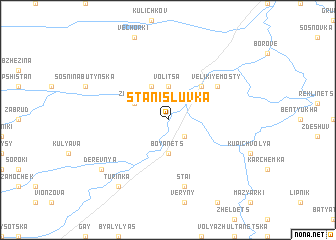
Stanisluvka (Ukraine)Stanisluvka is a town in Ukraine. An overview map of the region around Stanisluvka is displayed below.
regional and 3d topo map of Stanisluvka, Ukraine ::
Stanisluvka airports ::
The nearest airport is LWO - Lvov Lviv Intl, located 44.3 km south of Stanisluvka.
Nearby towns ::
Pod Zhekon (2.2km south east) //
Volitsa (3.7km north) //
Boyanets (3.7km south) //
Dvortse (3.9km north) //
Ploske (3.9km north) //
Zazheka (3.0km north west) //
Staryye Mosty (4.4km north east) //
Velikiye Mosty (5.1km north east) //
Stai (7.5km south) //
Derevnya (7.3km south west) //
Turinka (8.2km south west) //
[all distances 'as the bird flies' and approximate] 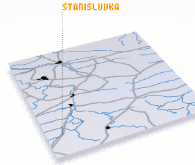 Places with similar names to Stanisluvka, Ukraine ::
// Stanislavka (UA)
// Stanislavka (UA)
// Stanislavka (UA)
// (( Stanislavka )) (UA)
// Stanislavca (MD)
Disclaimer :: Information on this page comes without warranty of any kind |
||
|
Where is Stanisluvka? Elevation and coordinates ::
Latitude (lat): 50°12'0"N Longitude (lon): 24°6'0"E
Elevation (approx.): 207m (map arrows pan, magnifying glasses zoom) |
||
|
Visiting Stanisluvka? Hotel/Accommodation ::
Book a hotel in Stanisluvka Travel Guide ::
Buy a travel guide for Ukraine rental cars ::
car rental offers GPS waypoint ::
download a GPX waypoint (PoI) of Stanisluvka for your GPS receiver
|
||