|
search place name
|
||
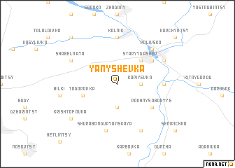
Yanyshëvka (Ukraine)Yanyshëvka is a town in Ukraine. An overview map of the region around Yanyshëvka is displayed below.
regional and 3d topo map of Yanyshëvka, Ukraine ::
Yanyshëvka airports ::
The nearest airport is IEV - Kiev Zhuliany Intl, located 177.2 km north east of Yanyshëvka.
Other airports nearby include KBP - Kiev Boryspil Intl (188.2 km north east), IAS - Iasi (238.3 km south west), Nearby towns ::
Alekseyevka (3.7km south) //
Kopiyevka (2.4km east) //
Staryy Dashev (4.4km north east) //
Todorovka (4.1km south west) //
Novyy Dashev (5.2km north east) //
Rakhny-Sobovyye (5.2km south east) //
Kalʼnik (7.4km north) //
Kamenogorka (4.9km east) //
Shura-Bonduryanskaya (7.5km south) //
Polivska (6.6km north east) //
Shabelʼnaya (6.1km north west) //
Dashev (6.1km north east) //
Bonduri (7.8km south) //
Krishtofovka (7.4km south west) //
Parkhomivka (8.9km north west) //
[all distances 'as the bird flies' and approximate] 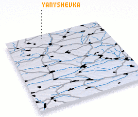 Places with similar names to Yanyshëvka, Ukraine ::
// Yanishevka (UA)
// Yunashevka (KZ)
Disclaimer :: Information on this page comes without warranty of any kind |
||
|
Where is Yanyshëvka? Elevation and coordinates ::
Latitude (lat): 48°58'0"N Longitude (lon): 29°23'0"E
Elevation (approx.): 231m (map arrows pan, magnifying glasses zoom) |
||
|
Visiting Yanyshëvka? Hotel/Accommodation ::
Book a hotel in Yanyshëvka Travel Guide ::
Buy a travel guide for Ukraine rental cars ::
car rental offers GPS waypoint ::
download a GPX waypoint (PoI) of Yanyshëvka for your GPS receiver
|
||