|
search place name
|
||
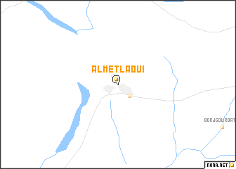
Al Metlaoui (Gafsa, Tunisia)Al Metlaoui is a town in the Gafsa region of Tunisia. An overview map of the region around Al Metlaoui is displayed below.
regional and 3d topo map of Al Metlaoui, Tunisia ::
Al Metlaoui airports ::
The nearest airport is GAF - Gafsa, located 40.1 km east of Al Metlaoui.
Other airports nearby include TOE - Tozeur Nefta (51.2 km south west), TEE - Tebessa Cheikh Larbi Tebessi (124.5 km north), GAE - Gabes (165.1 km east), CZL - Constantine Mohamed Boudiaf Intl (269.5 km north west), Nearby towns ::
Philippe-Thomas (2.4km south east) //
[all distances 'as the bird flies' and approximate] 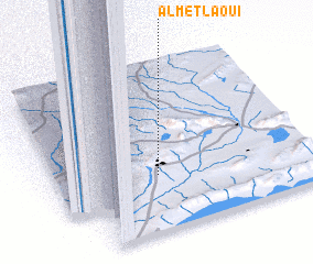 Places with similar names to Al Metlaoui, Tunisia ::
// Alamedilla (ES)
// Ālamtala (BD)
// Al Mudaylī (OM)
// Alamoutala (ML)
// Al Maţla‘ (IQ)
// Al Ma‘dilah (LB)
// Al Maḑla‘ah (YE)
// Al Mţaylah (LB)
// Al Mţullah (LB)
// Al Mţullah (LB)
Disclaimer :: Information on this page comes without warranty of any kind |
||
|
Where is Al Metlaoui? Elevation and coordinates ::
Latitude (lat): 34°20'0"N Longitude (lon): 8°24'0"E
Elevation (approx.): 240m (map arrows pan, magnifying glasses zoom) |
||
|
Visiting Al Metlaoui? Hotel/Accommodation ::
Book a hotel in Al Metlaoui Travel Guide ::
Buy a travel guide for Tunisia rental cars ::
car rental offers GPS waypoint ::
download a GPX waypoint (PoI) of Al Metlaoui for your GPS receiver
|
||