|
search place name
|
||
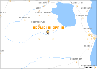
Ar Rijāl al Aroua (Monastir, Tunisia)Ar Rijāl al Aroua is a town in the Monastir region of Tunisia. An overview map of the region around Ar Rijāl al Aroua is displayed below.
regional and 3d topo map of Ar Rijāl al Aroua, Tunisia ::
Ar Rijāl al Aroua airports ::
The nearest airport is MIR - Monastir Habib Bourguiba Intl, located 29.8 km north west of Ar Rijāl al Aroua.
Other airports nearby include SFA - Sfax Thyna (90.6 km south), LMP - Lampedusa (155.9 km east), TUN - Tunis Carthage (160.0 km north), PNL - Pantelleria (173.4 km north east), Nearby towns ::
Sīdī Bin Nūr (2.4km north east) //
Al Jawāwidah (2.4km south east) //
Ḩamādat al Kebalou (3.5km south west) //
Sīdī an Nu‘ayjah (4.8km north west) //
Bin Ḩamīd (7.4km north) //
Al Graa (8.0km north) //
[all distances 'as the bird flies' and approximate]  Places with similar names to Ar Rijāl al Aroua, Tunisia :: Disclaimer :: Information on this page comes without warranty of any kind |
||
|
Where is Ar Rijāl al Aroua? Elevation and coordinates ::
Latitude (lat): 35°31'0"N Longitude (lon): 10°54'0"E
Elevation (approx.): 17m (map arrows pan, magnifying glasses zoom) |
||
|
Visiting Ar Rijāl al Aroua? Hotel/Accommodation ::
Book a hotel in Ar Rijāl al Aroua Travel Guide ::
Buy a travel guide for Tunisia rental cars ::
car rental offers GPS waypoint ::
download a GPX waypoint (PoI) of Ar Rijāl al Aroua for your GPS receiver
|
||