|
search place name
|
||
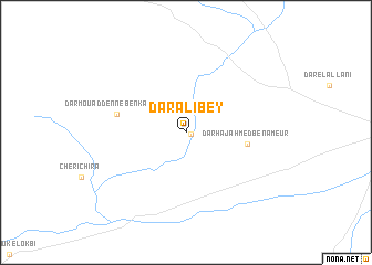
Dar Ali Bey (Kairouan, Tunisia)Dar Ali Bey is a town in the Kairouan region of Tunisia. An overview map of the region around Dar Ali Bey is displayed below.
regional and 3d topo map of Dar Ali Bey, Tunisia ::
Dar Ali Bey airports ::
The nearest airport is MIR - Monastir Habib Bourguiba Intl, located 77.0 km east of Dar Ali Bey.
Other airports nearby include SFA - Sfax Thyna (128.0 km south east), TUN - Tunis Carthage (133.3 km north), TEE - Tebessa Cheikh Larbi Tebessi (164.5 km west), GAF - Gafsa (171.0 km south west), Nearby towns ::
Dar el Haj Mabrouk (0.4km east) //
Dar Haj Ahmed Ben Ameur (5.1km east) //
Dar Mouaddenne Ben Kassem (6.0km west) //
[all distances 'as the bird flies' and approximate]  Places with similar names to Dar Ali Bey, Tunisia ::
// Trilby (US)
// Torralba (CU)
// Türlübey (TR)
// Dār al Bāy (TN)
// Dar el Bey (TN)
// Torralba (ES)
// Trilby (US)
// Turrialba (CR)
// Ţarlāb (IR)
// Torrealba (VE)
Disclaimer :: Information on this page comes without warranty of any kind |
||
|
Where is Dar Ali Bey? Elevation and coordinates ::
Latitude (lat): 35°40'39"N Longitude (lon): 9°54'36"E
Elevation (approx.): 81m (map arrows pan, magnifying glasses zoom) |
||
|
Visiting Dar Ali Bey? Hotel/Accommodation ::
Book a hotel in Dar Ali Bey Travel Guide ::
Buy a travel guide for Tunisia rental cars ::
car rental offers GPS waypoint ::
download a GPX waypoint (PoI) of Dar Ali Bey for your GPS receiver
|
||