|
search place name
|
||
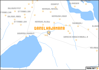
Dar el Haj Amara (Sousse, Tunisia)Dar el Haj Amara is a town in the Sousse region of Tunisia. An overview map of the region around Dar el Haj Amara is displayed below.
regional and 3d topo map of Dar el Haj Amara, Tunisia ::
Dar el Haj Amara airports ::
The nearest airport is MIR - Monastir Habib Bourguiba Intl, located 39.0 km south east of Dar el Haj Amara.
Other airports nearby include TUN - Tunis Carthage (103.5 km north), SFA - Sfax Thyna (137.1 km south), PNL - Pantelleria (173.8 km north east), GAF - Gafsa (218.8 km south west), Nearby towns ::
Henndi ech Chiab (0.8km west) //
Henndi Oulad Saïd (1.3km west) //
Henndi Knana (4.0km north east) //
Henndi el Alouj (4.4km north west) //
Sidi et Taïari (5.0km north) //
Mashtá ash Shuwayshah (4.5km north east) //
Henndi Salmoun (6.8km north east) //
Henndi es Setta (6.2km north east) //
Henndi el Haj Brahim (6.0km east) //
Henndi et Teggaz (6.2km east) //
Henndi es Saada (7.2km north east) //
Henndi el Menzel (8.8km north) //
Douar Oulad Aoun (7.2km west) //
Sidi Khalifa el Ferjani (8.9km north west) //
[all distances 'as the bird flies' and approximate]  Places with similar names to Dar el Haj Amara, Tunisia ::
// Dar el Haj Omar (MA)
Disclaimer :: Information on this page comes without warranty of any kind |
||
|
Where is Dar el Haj Amara? Elevation and coordinates ::
Latitude (lat): 35°55'34"N Longitude (lon): 10°22'33"E
Elevation (approx.): 20m (map arrows pan, magnifying glasses zoom) |
||
|
Visiting Dar el Haj Amara? Hotel/Accommodation ::
Book a hotel in Dar el Haj Amara Travel Guide ::
Buy a travel guide for Tunisia rental cars ::
car rental offers GPS waypoint ::
download a GPX waypoint (PoI) of Dar el Haj Amara for your GPS receiver
|
||