|
search place name
|
||
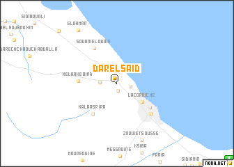
Dar el Saïd (Sousse, Tunisia)Dar el Saïd is a town in the Sousse region of Tunisia. An overview map of the region around Dar el Saïd is displayed below.
regional and 3d topo map of Dar el Saïd, Tunisia ::
Dar el Saïd airports ::
The nearest airport is MIR - Monastir Habib Bourguiba Intl, located 19.2 km south east of Dar el Saïd.
Other airports nearby include TUN - Tunis Carthage (113.7 km north), SFA - Sfax Thyna (128.1 km south), PNL - Pantelleria (162.2 km north east), DJE - Djerba Zarzis (221.9 km south), Nearby towns ::
Hammam Sousse (1.2km south) //
Villa des Pins (1.8km east) //
Akouda (2.2km west) //
La Corniche (4.5km south east) //
Kelaa Kebira (5.0km west) //
Kalaa Srira (5.8km south west) //
Sidi Bou Jafer (5.7km south east) //
Souani el Adari (6.4km north west) //
Sousse (6.6km south east) //
El Ahmar (9.9km north west) //
[all distances 'as the bird flies' and approximate] 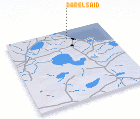 Places with similar names to Dar el Saïd, Tunisia ::
// Trail City (US)
// Dîrleşti (RO)
// Ţăruleşti (RO)
// Ţîrleşti (RO)
// Tîrleşti (RO)
// Ţurloeşti (RO)
// Trail City (US)
// Ter Aalst (NL)
// Deir el Asad (IL)
// Durleşti (MD)
Disclaimer :: Information on this page comes without warranty of any kind |
||
|
Where is Dar el Saïd? Elevation and coordinates ::
Latitude (lat): 35°52'10"N Longitude (lon): 10°35'33"E
Elevation (approx.): 7m (map arrows pan, magnifying glasses zoom) |
||
|
Visiting Dar el Saïd? Hotel/Accommodation ::
Book a hotel in Dar el Saïd Travel Guide ::
Buy a travel guide for Tunisia rental cars ::
car rental offers GPS waypoint ::
download a GPX waypoint (PoI) of Dar el Saïd for your GPS receiver
|
||