|
search place name
|
||
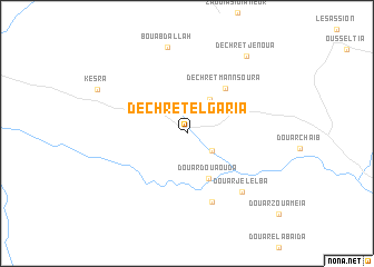
Dechret el Garia (Siliana, Tunisia)Dechret el Garia is a town in the Siliana region of Tunisia. An overview map of the region around Dechret el Garia is displayed below.
regional and 3d topo map of Dechret el Garia, Tunisia ::
Dechret el Garia airports ::
The nearest airport is MIR - Monastir Habib Bourguiba Intl, located 118.4 km east of Dechret el Garia.
Other airports nearby include TEE - Tebessa Cheikh Larbi Tebessi (125.8 km west), TUN - Tunis Carthage (138.8 km north east), GAF - Gafsa (160.2 km south), SFA - Sfax Thyna (162.9 km south east), Nearby towns ::
Ech Cheriha (2.6km south east) //
Dechret Beni Abdallah (3.9km north east) //
Douar Douaouda (4.8km south) //
Dechret Mannsoura (5.5km north east) //
Dechret Jelelba (7.2km south) //
Douar Jelelba (7.4km south east) //
Bou Abdallah (8.8km north) //
Dechret Jenoua (9.2km north east) //
[all distances 'as the bird flies' and approximate] 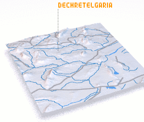 Places with similar names to Dechret el Garia, Tunisia :: Disclaimer :: Information on this page comes without warranty of any kind |
||
|
Where is Dechret el Garia? Elevation and coordinates ::
Latitude (lat): 35°46'20"N Longitude (lon): 9°26'42"E
Elevation (approx.): 641m (map arrows pan, magnifying glasses zoom) |
||
|
Visiting Dechret el Garia? Hotel/Accommodation ::
Book a hotel in Dechret el Garia Travel Guide ::
Buy a travel guide for Tunisia rental cars ::
car rental offers GPS waypoint ::
download a GPX waypoint (PoI) of Dechret el Garia for your GPS receiver
|
||