|
search place name
|
||
Douar Dagma (Bizerte, Tunisia)Douar Dagma is a town in the Bizerte region of Tunisia. An overview map of the region around Douar Dagma is displayed below.
regional and 3d topo map of Douar Dagma, Tunisia ::

Douar Dagma airports ::
The nearest airport is TUN - Tunis Carthage, located 27.8 km east of Douar Dagma.
Other airports nearby include MIR - Monastir Habib Bourguiba Intl (150.2 km south east), TEE - Tebessa Cheikh Larbi Tebessi (233.6 km south west), Nearby towns ::
Sidi Othman (2.1km north west) //
Douar el Mabtouha (3.3km north) //
Douar Zaouia el Kebira (4.4km south east) //
Sidi Messaoud (4.5km south east) //
Dawwār ‘Unq al Jamal (5.1km south east) //
Douar Seka Kebir (5.3km north west) //
Douar Seka Sghir (5.7km north west) //
De Carnières (5.5km east) //
Chaouat (7.0km south) //
Borj Hadida (6.0km west) //
Douar Zaouia es Sghira (6.4km south east) //
Douar Lezdine (6.5km east) //
Douar Bessouf (7.0km north west) //
Douar Mennzel Ameur (7.0km south east) //
Douar Mennzel Rached (7.0km east) //
Dar el Beïda (8.0km south east) //
Dawwār Henna (9.0km south east) //
Douar es Sakkak (8.7km north west) //
Douar el Bachir (10.5km north west) //
[all distances 'as the bird flies' and approximate] 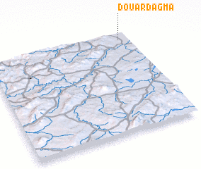 Places with similar names to Douar Dagma, Tunisia ::
// Tradukoma (TP)
// Dar Tiguemmi (MA)
Disclaimer :: Information on this page comes without warranty of any kind |
||
|
Where is Douar Dagma? Elevation and coordinates ::
Latitude (lat): 36°56'16"N Longitude (lon): 9°56'6"E
Elevation (approx.): 9m (map arrows pan, magnifying glasses zoom) |
||
|
Visiting Douar Dagma? Hotel/Accommodation ::
Book a hotel in Douar Dagma Travel Guide ::
Buy a travel guide for Tunisia rental cars ::
car rental offers GPS waypoint ::
download a GPX waypoint (PoI) of Douar Dagma for your GPS receiver
|
||