|
search place name
|
||
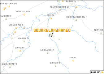
Douar el Haj Ahmed (Jendouba, Tunisia)Douar el Haj Ahmed is a town in the Jendouba region of Tunisia. An overview map of the region around Douar el Haj Ahmed is displayed below.
regional and 3d topo map of Douar el Haj Ahmed, Tunisia ::
Douar el Haj Ahmed airports ::
The nearest airport is AAE - Annaba, located 104.4 km west of Douar el Haj Ahmed.
Other airports nearby include TUN - Tunis Carthage (124.0 km east), TEE - Tebessa Cheikh Larbi Tebessi (138.6 km south west), MIR - Monastir Habib Bourguiba Intl (185.7 km south east), SFA - Sfax Thyna (255.6 km south east), Nearby towns ::
Sidi Bou Choucha (2.3km east) //
Sidi es Sabbih (5.9km south) //
Chalbi (6.7km north) //
Sīdī az Zaouem (9.0km north) //
Ben Bechir (8.7km north west) //
Mohammed Bessaïs (9.3km north east) //
Zaouia (10.6km south east) //
[all distances 'as the bird flies' and approximate] 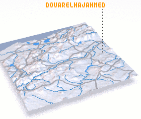 Places with similar names to Douar el Haj Ahmed, Tunisia ::
// Douar el Hajj Ahmed (MA)
// Dawwār al Ḩajj Aḩmad (EG)
// Dar el Haj Ahmed (TN)
// Dawwār al Ḩājj Aḩmad (TN)
// Dawwār al Ḩājj Aḩmad (TN)
// Douar el Haj Ahmed (TN)
Disclaimer :: Information on this page comes without warranty of any kind |
||
|
Where is Douar el Haj Ahmed? Elevation and coordinates ::
Latitude (lat): 36°30'14"N Longitude (lon): 8°54'29"E
Elevation (approx.): 141m (map arrows pan, magnifying glasses zoom) |
||
|
Visiting Douar el Haj Ahmed? Hotel/Accommodation ::
Book a hotel in Douar el Haj Ahmed Travel Guide ::
Buy a travel guide for Tunisia rental cars ::
car rental offers GPS waypoint ::
download a GPX waypoint (PoI) of Douar el Haj Ahmed for your GPS receiver
|
||