|
search place name
|
||
Kebeur el Jaheli (Ariana, Tunisia)Kebeur el Jaheli is a town in the Ariana region of Tunisia. An overview map of the region around Kebeur el Jaheli is displayed below.
regional and 3d topo map of Kebeur el Jaheli, Tunisia ::

Kebeur el Jaheli airports ::
The nearest airport is TUN - Tunis Carthage, located 15.3 km south east of Kebeur el Jaheli.
Other airports nearby include MIR - Monastir Habib Bourguiba Intl (144.8 km south east), PNL - Pantelleria (166.0 km east), TEE - Tebessa Cheikh Larbi Tebessi (246.5 km south west), Nearby towns ::
Douar Gabrejelli (1.2km south west) //
Douar Sidi Bou Hanech (2.5km north east) //
Borj et Touil (3.6km south east) //
La Sebala (4.6km south) //
Douar Charbi (5.0km north) //
Borj Ali Ben Ammar (5.3km north) //
Jaafar (5.2km south east) //
Douar Kaouana (5.0km north west) //
Borj el Khouja (5.2km south west) //
Protville (6.2km north west) //
Dar Naheli (7.1km south) //
Mennzel el Henndi (6.1km east) //
Douar Cherfech (6.2km west) //
Zebbas (8.0km south west) //
Sidi Tabet (8.1km south west) //
Jafar (10.4km south east) //
[all distances 'as the bird flies' and approximate] 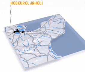 Places with similar names to Kebeur el Jaheli, Tunisia :: Disclaimer :: Information on this page comes without warranty of any kind |
||
|
Where is Kebeur el Jaheli? Elevation and coordinates ::
Latitude (lat): 36°57'21"N Longitude (lon): 10°6'55"E
Elevation (approx.): 6m (map arrows pan, magnifying glasses zoom) |
||
|
Visiting Kebeur el Jaheli? Hotel/Accommodation ::
Book a hotel in Kebeur el Jaheli Travel Guide ::
Buy a travel guide for Tunisia rental cars ::
car rental offers GPS waypoint ::
download a GPX waypoint (PoI) of Kebeur el Jaheli for your GPS receiver
|
||