|
search place name
|
||
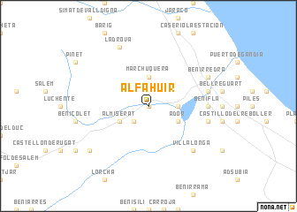
Alfahuir (Comunidad Valenciana, Spain)Alfahuir is a town in the Comunidad Valenciana region of Spain. An overview map of the region around Alfahuir is displayed below.
regional and 3d topo map of Alfahuir, Spain ::
Alfahuir airports ::
The nearest airport is VLC - Valencia, located 64.9 km north of Alfahuir.
Other airports nearby include ALC - Alicante (77.1 km south), MJV - Murcia San Javier (137.7 km south), IBZ - Ibiza (141.0 km east), Nearby towns ::
Rótova (0.0km north) //
Castellonet (2.3km south west) //
Palma de Gandía (2.9km east) //
Marchuquera (3.7km north) //
Ador (3.4km south east) //
Almiserat (3.4km south west) //
Lugar Nuevo de San Jerónimo (3.4km south west) //
Beniflá (5.8km east) //
Beniarjó (5.8km east) //
Potríes (6.1km east) //
Real de Gandía (6.1km east) //
Almoines (6.1km east) //
Villalonga (7.0km south east) //
La Drova (8.0km north) //
Benirredrá (6.9km north east) //
Beniopa (6.9km north east) //
Gandía (6.9km north east) //
Benipeixcar (6.9km north east) //
Terrateig (8.0km south west) //
[all distances 'as the bird flies' and approximate] 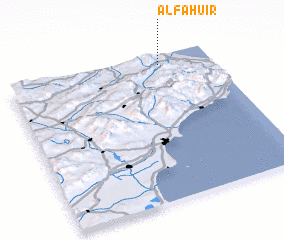 Places with similar names to Alfahuir, Spain :: Disclaimer :: Information on this page comes without warranty of any kind |
||
|
Where is Alfahuir? Elevation and coordinates ::
Latitude (lat): 38°56'0"N Longitude (lon): 0°15'0"W
Elevation (approx.): 80m (map arrows pan, magnifying glasses zoom) |
||
|
Visiting Alfahuir? Hotel/Accommodation ::
Book a hotel in Alfahuir Travel Guide ::
Buy a travel guide for Spain rental cars ::
car rental offers GPS waypoint ::
download a GPX waypoint (PoI) of Alfahuir for your GPS receiver
|
||