|
search place name
|
||
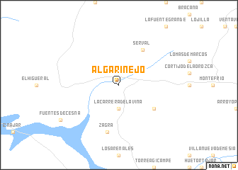
Algarinejo (Andalucía, Spain)Algarinejo is a town in the Andalucía region of Spain. An overview map of the region around Algarinejo is displayed below.
regional and 3d topo map of Algarinejo, Spain ::
Algarinejo airports ::
The nearest airport is GRX - Granada, located 36.0 km south east of Algarinejo.
Other airports nearby include GRX - Granada Armilla (50.0 km south east), AGP - Malaga (77.7 km south west), ODB - Cordoba (84.9 km north west), OZP - Sevilla Moron Ab (131.0 km west), Nearby towns ::
La Carrera de la Viña (3.7km south) //
Serval (6.3km north east) //
Cortijada Los Chorreros (5.8km south east) //
Zagra (7.6km south) //
[all distances 'as the bird flies' and approximate] 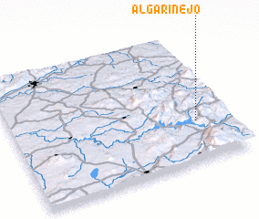 Places with similar names to Algarinejo, Spain ::
// Algrange (FR)
Disclaimer :: Information on this page comes without warranty of any kind |
||
|
Where is Algarinejo? Elevation and coordinates ::
Latitude (lat): 37°19'0"N Longitude (lon): 4°9'0"W
Elevation (approx.): 826m (map arrows pan, magnifying glasses zoom) |
||
|
Visiting Algarinejo? Hotel/Accommodation ::
Book a hotel in Algarinejo Travel Guide ::
Buy a travel guide for Spain rental cars ::
car rental offers GPS waypoint ::
download a GPX waypoint (PoI) of Algarinejo for your GPS receiver
|
||