|
search place name
|
||
Amarela (Galicia, Spain)Amarela is a town in the Galicia region of Spain. An overview map of the region around Amarela is displayed below.
regional and 3d topo map of Amarela, Spain ::

Amarela airports ::
The nearest airport is SCQ - Santiago, located 66.9 km east of Amarela.
Other airports nearby include LCG - La Coruna A Coruna (80.8 km north east), VGO - Vigo (92.5 km south east), OPO - Porto (192.7 km south), VRL - Vila Real (222.7 km south east), Nearby towns ::
Vilar (1.4km east) //
Sardiñeiro de Abajo (1.4km west) //
Estorde (1.9km north) //
Redonda (2.3km south east) //
Sardiñeiro (2.3km north west) //
Oliveira (2.7km east) //
Quenje (2.7km east) //
Sembra (3.7km north) //
Castro (2.7km west) //
Mallas (2.7km west) //
Duyo (2.7km west) //
Finisterre (3.9km south) //
Toba (3.9km north) //
Toba de Abajo (3.9km north) //
Toba de Arriba (3.9km north) //
San Martín de Arriba (3.3km south west) //
Padris (3.9km north) //
Buján (3.3km north west) //
Denle (3.3km north west) //
Lagarteira (4.6km north east) //
Son (4.6km north east) //
Insúa (4.6km south west) //
Tedín (5.6km north) //
Ruibo (5.6km north) //
Duyo (4.1km west) //
Cabaleriza (5.7km north) //
Lagoa (5.7km north) //
Canosa (5.7km north) //
Brens (4.5km north east) //
[all distances 'as the bird flies' and approximate] 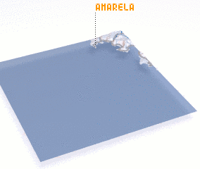 Places with similar names to Amarela, Spain ::
Disclaimer :: Information on this page comes without warranty of any kind |
||
|
Where is Amarela? Elevation and coordinates ::
Latitude (lat): 42°56'0"N Longitude (lon): 9°14'0"W
Elevation (approx.): 19m (map arrows pan, magnifying glasses zoom) |
||
|
Visiting Amarela? Hotel/Accommodation ::
Book a hotel in Amarela Travel Guide ::
Buy a travel guide for Spain rental cars ::
car rental offers GPS waypoint ::
download a GPX waypoint (PoI) of Amarela for your GPS receiver
|
||