|
search place name
|
||
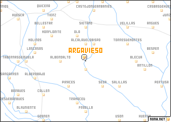
Argavieso (Aragón, Spain)Argavieso is a town in the Aragón region of Spain. An overview map of the region around Argavieso is displayed below.
regional and 3d topo map of Argavieso, Spain ::
Argavieso airports ::
The nearest airport is ZAZ - Zaragoza Ab, located 76.0 km south west of Argavieso.
Other airports nearby include LDE - Tarbes Lourdes (127.4 km north), PNA - Pamplona (137.8 km north west), LEU - Seo De Urgel (143.4 km east), PUF - Pau Pyrenees (148.2 km north), Nearby towns ::
Novales (1.9km south) //
Pueyo de Fañanás (2.3km north east) //
Alcalá del Obispo (3.7km north) //
Fañanás (4.0km north) //
Albero Alto (4.1km west) //
Ola (5.7km north) //
Sesa (6.2km south east) //
Piracés (6.2km south west) //
Siétamo (7.4km north) //
Salillas (7.8km south east) //
Monflorite (7.8km north west) //
[all distances 'as the bird flies' and approximate] 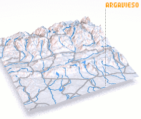
Disclaimer :: Information on this page comes without warranty of any kind |
||
|
Where is Argavieso? Elevation and coordinates ::
Latitude (lat): 42°3'0"N Longitude (lon): 0°17'0"W
Elevation (approx.): 457m (map arrows pan, magnifying glasses zoom) |
||
|
Visiting Argavieso? Hotel/Accommodation ::
Book a hotel in Argavieso Travel Guide ::
Buy a travel guide for Spain rental cars ::
car rental offers GPS waypoint ::
download a GPX waypoint (PoI) of Argavieso for your GPS receiver
|
||