|
search place name
|
||
Armariz (Galicia, Spain)Armariz is a town in the Galicia region of Spain. An overview map of the region around Armariz is displayed below.
regional and 3d topo map of Armariz, Spain ::

Armariz airports ::
The nearest airport is VGO - Vigo, located 72.4 km west of Armariz.
Other airports nearby include SCQ - Santiago (91.7 km north west), BGC - Braganca (95.9 km south east), VRL - Vila Real (106.5 km south), LCG - La Coruna A Coruna (129.3 km north west), Nearby towns ::
Cantoña (1.9km north) //
Golpellás (1.9km north) //
Espiñeiros (2.3km south west) //
Coucieiro (2.3km north west) //
Aguas Santas (2.7km west) //
Ambía (3.3km south east) //
Junquera de Ambía (4.0km south) //
Villanueva (4.0km south) //
Figueiredo (4.0km north) //
Figueiroá (4.0km north) //
Requejo de Valverde (5.6km south) //
Ribeira (4.1km east) //
Folgoso (4.5km south west) //
Betán (4.5km north east) //
Solveira (5.7km north) //
Siabal (5.7km north) //
Piuca-Araújo (5.5km north east) //
Taboadela (5.5km west) //
La Graña (7.5km south) //
Moreiras (7.5km north) //
Almoite (5.8km east) //
Bobadela (6.9km south east) //
Allariz (6.9km south west) //
Mourisco (6.9km north east) //
Rábeda (6.9km north west) //
Poedo (6.6km south east) //
Calvelle (7.9km north) //
Abeleda (8.5km south east) //
Pazos (8.5km north west) //
[all distances 'as the bird flies' and approximate] 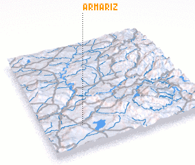
Disclaimer :: Information on this page comes without warranty of any kind |
||
|
Where is Armariz? Elevation and coordinates ::
Latitude (lat): 42°14'0"N Longitude (lon): 7°45'0"W
Elevation (approx.): 536m (map arrows pan, magnifying glasses zoom) |
||
|
Visiting Armariz? Hotel/Accommodation ::
Book a hotel in Armariz Travel Guide ::
Buy a travel guide for Spain rental cars ::
car rental offers GPS waypoint ::
download a GPX waypoint (PoI) of Armariz for your GPS receiver
|
||