|
search place name
|
||
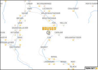
Bausén (Cataluña, Spain)Bausén is a town in the Cataluña region of Spain. An overview map of the region around Bausén is displayed below.
regional and 3d topo map of Bausén, Spain ::
Bausén airports ::
The nearest airport is LDE - Tarbes Lourdes, located 70.3 km north west of Bausén.
Other airports nearby include LEU - Seo De Urgel (79.1 km south east), LRH - La Rochelle Lherm (81.6 km north east), TLS - Toulouse Blagnac (102.9 km north east), PUF - Pau Pyrenees (110.6 km north west), Nearby towns ::
Les (1.9km south) //
Caneján (2.7km east) //
Fos (3.9km north) //
Argut-Dessous (5.6km north) //
Bosost (5.7km south) //
Melles (5.5km north east) //
Argut-Dessus (7.5km north) //
Arlos (7.5km north) //
[all distances 'as the bird flies' and approximate] 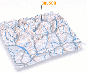 Places with similar names to Bausén, Spain ::
Disclaimer :: Information on this page comes without warranty of any kind |
||
|
Where is Bausén? Elevation and coordinates ::
Latitude (lat): 42°50'0"N Longitude (lon): 0°43'0"W
Elevation (approx.): 859m (map arrows pan, magnifying glasses zoom) |
||
|
Visiting Bausén? Hotel/Accommodation ::
Book a hotel in Bausén Travel Guide ::
Buy a travel guide for Spain rental cars ::
car rental offers GPS waypoint ::
download a GPX waypoint (PoI) of Bausén for your GPS receiver
|
||