|
search place name
|
||
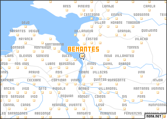
Bemantes (Galicia, Spain)Bemantes is a town in the Galicia region of Spain. An overview map of the region around Bemantes is displayed below.
regional and 3d topo map of Bemantes, Spain ::
Bemantes airports ::
The nearest airport is LCG - La Coruna A Coruna, located 14.8 km west of Bemantes.
Other airports nearby include SCQ - Santiago (51.6 km south), VGO - Vigo (127.3 km south), BGC - Braganca (204.6 km south east), Nearby towns ::
Morujo (1.3km west) //
Miño (1.9km north) //
Telle (2.0km north) //
Viñas (2.3km south east) //
Leiro (2.3km north east) //
Punta Bañobre (3.5km north) //
Ouces (2.7km west) //
Souto (3.7km south) //
Tiobre (3.7km south) //
Bergondo (3.3km south west) //
Castro (3.9km north) //
Villozás (4.6km south east) //
Pontellas (4.6km south west) //
Carantoña (4.6km north east) //
Betanzos (5.6km south) //
Villanueva (5.6km north) //
Neda (4.0km east) //
Callobre (4.0km east) //
Güimil (4.4km south east) //
Babío (4.4km south west) //
Viñas (5.7km south) //
Armea (5.7km south) //
Boebre (5.7km north) //
Obre (5.7km south) //
Perbes (5.7km north) //
Villarmayor (4.4km north east) //
Sada (4.4km north west) //
Paderne (6.2km south east) //
Andrade (6.2km north east) //
[all distances 'as the bird flies' and approximate] 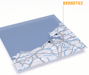 Places with similar names to Bemantes, Spain ::
Disclaimer :: Information on this page comes without warranty of any kind |
||
|
Where is Bemantes? Elevation and coordinates ::
Latitude (lat): 43°20'0"N Longitude (lon): 8°12'0"W
Elevation (approx.): 33m (map arrows pan, magnifying glasses zoom) |
||
|
Visiting Bemantes? Hotel/Accommodation ::
Book a hotel in Bemantes Travel Guide ::
Buy a travel guide for Spain rental cars ::
car rental offers GPS waypoint ::
download a GPX waypoint (PoI) of Bemantes for your GPS receiver
|
||