|
search place name
|
||
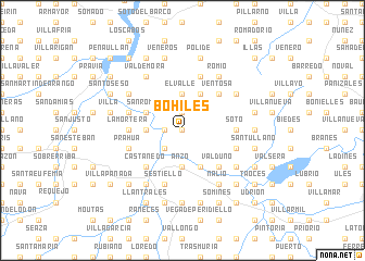
Bohiles (Asturias, Spain)Bohiles is a town in the Asturias region of Spain. An overview map of the region around Bohiles is displayed below.
regional and 3d topo map of Bohiles, Spain ::
Bohiles airports ::
The nearest airport is OVD - Aviles Asturias, located 14.5 km north of Bohiles.
Other airports nearby include BGC - Braganca (183.5 km south), VLL - Valladolid (215.0 km south east), Nearby towns ::
Villar (0.0km north) //
Murias (0.0km north) //
El Campo (1.3km west) //
Grullos (1.3km west) //
Sandiche (1.3km west) //
Llamero (1.9km north) //
Figaredo (2.3km south west) //
Agüera (2.3km south west) //
Cuero (2.3km south west) //
Anzo (3.7km south) //
Peñaflor (3.7km south) //
El Valle (3.7km north) //
Aces (2.7km west) //
Bolgues (3.9km south) //
Ferreros (3.9km north) //
Mafalla (3.9km north) //
San Román (3.3km north west) //
Valduno (4.6km south east) //
Ventosa (4.6km north east) //
Faces (4.6km north east) //
Castañedo (4.6km south west) //
Alcedo (4.0km east) //
La Mortera (4.0km west) //
Soto (4.0km east) //
Pandiello (5.7km north) //
Prahúa (4.4km south west) //
Lazana (4.4km south east) //
Cerecedo (4.4km north west) //
San Tirso (4.4km north west) //
[all distances 'as the bird flies' and approximate]  Places with similar names to Bohiles, Spain ::
Disclaimer :: Information on this page comes without warranty of any kind |
||
|
Where is Bohiles? Elevation and coordinates ::
Latitude (lat): 43°26'0"N Longitude (lon): 6°2'0"W
Elevation (approx.): 254m (map arrows pan, magnifying glasses zoom) |
||
|
Visiting Bohiles? Hotel/Accommodation ::
Book a hotel in Bohiles Travel Guide ::
Buy a travel guide for Spain rental cars ::
car rental offers GPS waypoint ::
download a GPX waypoint (PoI) of Bohiles for your GPS receiver
|
||