|
search place name
|
||
Brincones (Castilla y León, Spain)Brincones is a town in the Castilla y León region of Spain. An overview map of the region around Brincones is displayed below.
regional and 3d topo map of Brincones, Spain ::

Brincones airports ::
The nearest airport is SLM - Salamanca, located 73.6 km east of Brincones.
Other airports nearby include BGC - Braganca (87.5 km north), VRL - Vila Real (116.3 km west), VLL - Valladolid (141.3 km north east), Nearby towns ::
Iruelos (3.4km north east) //
Ahigal de Villarino (4.0km north) //
Carrasco (3.4km south west) //
Villargordo (4.6km south east) //
Villarmuerto (7.4km south) //
Robledo Hermoso (5.9km west) //
Puertas (6.7km south east) //
Sanchón de la Ribera (6.7km south west) //
Zarza de Don Beltrán (7.9km north west) //
Espadaña (7.9km south east) //
El Manzano (9.3km north east) //
[all distances 'as the bird flies' and approximate] 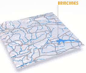 Places with similar names to Brincones, Spain ::
// Brancanes (PT)
// Barrancones (SV)
// Barrancones (MX)
// Barrancones (MX)
// Barrancones (HN)
// Barrancones (VE)
// Barrancones (VE)
// Barrancones (VE)
// Barrancones (VE)
// Brongonzué (CI)
Disclaimer :: Information on this page comes without warranty of any kind |
||
|
Where is Brincones? Elevation and coordinates ::
Latitude (lat): 41°7'0"N Longitude (lon): 6°21'0"W
Elevation (approx.): 767m (map arrows pan, magnifying glasses zoom) |
||
|
Visiting Brincones? Hotel/Accommodation ::
Book a hotel in Brincones Travel Guide ::
Buy a travel guide for Spain rental cars ::
car rental offers GPS waypoint ::
download a GPX waypoint (PoI) of Brincones for your GPS receiver
|
||