|
search place name
|
||
Callosa de Ensarriá (Comunidad Valenciana, Spain)Callosa de Ensarriá is a town in the Comunidad Valenciana region of Spain. An overview map of the region around Callosa de Ensarriá is displayed below.
regional and 3d topo map of Callosa de Ensarriá, Spain ::

Callosa de Ensarriá airports ::
The nearest airport is ALC - Alicante, located 56.1 km south west of Callosa de Ensarriá.
Other airports nearby include VLC - Valencia (98.4 km north), MJV - Murcia San Javier (114.7 km south west), IBZ - Ibiza (131.8 km east), Nearby towns ::
La Nucía (3.7km south) //
Polop (3.7km south) //
Tárbena (4.0km north) //
Bolulla (4.0km north) //
Carbonera (5.7km south) //
Cautivador (5.7km south) //
Bernia (5.8km east) //
Llano del Castillo (7.1km south east) //
Guadalest (6.9km north west) //
Partidor (6.9km south east) //
Foyes Blanques (8.0km south) //
Altea (8.0km south east) //
Albir (8.6km south east) //
Castell de Castells (9.4km north west) //
[all distances 'as the bird flies' and approximate] 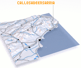 Places with similar names to Callosa de Ensarriá, Spain ::
Disclaimer :: Information on this page comes without warranty of any kind |
||
|
Where is Callosa de Ensarriá? Elevation and coordinates ::
Latitude (lat): 38°39'0"N Longitude (lon): 0°7'0"W
Elevation (approx.): 203m (map arrows pan, magnifying glasses zoom) |
||
|
Visiting Callosa de Ensarriá? Hotel/Accommodation ::
Book a hotel in Callosa de Ensarriá Travel Guide ::
Buy a travel guide for Spain rental cars ::
car rental offers GPS waypoint ::
download a GPX waypoint (PoI) of Callosa de Ensarriá for your GPS receiver
|
||