|
search place name
|
||
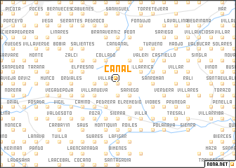
Canal (Asturias, Spain)Canal is a town in the Asturias region of Spain. An overview map of the region around Canal is displayed below.
regional and 3d topo map of Canal, Spain ::
Canal airports ::
The nearest airport is OVD - Aviles Asturias, located 42.5 km north west of Canal.
Other airports nearby include SDR - Santander (140.1 km east), BGC - Braganca (197.5 km south west), VLL - Valladolid (198.5 km south), Nearby towns ::
La Vega (0.0km north) //
La Cuesta (0.0km north) //
Villar (1.3km west) //
Pedrosa (1.3km east) //
Santianes (1.9km south) //
La Masanti (1.9km south) //
Nora (1.9km south) //
La Huelga (2.3km north east) //
Fabares (2.3km north east) //
Sariego (2.3km south east) //
La Rimada (2.7km west) //
Miyares (2.7km west) //
Lauría (3.3km north east) //
Villarrica (3.3km north east) //
Villanueva (3.3km south west) //
Sopeñas (3.9km north) //
Morvís (3.9km north) //
Collado (3.9km north) //
El Remedio (3.9km south) //
Lieres (3.9km south) //
Pedrera (3.9km south) //
Faya (3.9km south) //
Trías (4.6km north east) //
Puelles (4.6km north east) //
San Pedro (4.6km north east) //
Argañoso (4.6km north west) //
Valeri (4.6km north east) //
La Piñera (4.6km north east) //
Corros (4.6km south west) //
[all distances 'as the bird flies' and approximate] 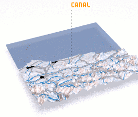 Places with similar names to Canal, Spain ::
Disclaimer :: Information on this page comes without warranty of any kind |
||
|
Where is Canal? Elevation and coordinates ::
Latitude (lat): 43°25'0"N Longitude (lon): 5°33'0"W
Elevation (approx.): 356m (map arrows pan, magnifying glasses zoom) |
||
|
Visiting Canal? Hotel/Accommodation ::
Book a hotel in Canal Travel Guide ::
Buy a travel guide for Spain rental cars ::
car rental offers GPS waypoint ::
download a GPX waypoint (PoI) of Canal for your GPS receiver
|
||