|
search place name
|
||
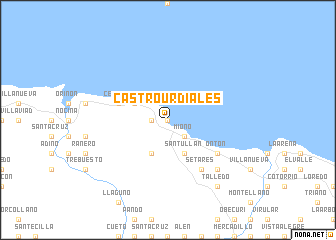
Castro-Urdiales (Cantabria, Spain)Castro-Urdiales is a town in the Cantabria region of Spain. An overview map of the region around Castro-Urdiales is displayed below.
regional and 3d topo map of Castro-Urdiales, Spain ::
Castro-Urdiales airports ::
The nearest airport is BIO - Bilbao, located 26.4 km east of Castro-Urdiales.
Other airports nearby include SDR - Santander (49.1 km west), VIT - Vitoria (68.5 km south east), EAS - San Sebastian (115.6 km east), BIQ - Biarritz-bayonne Anglet (137.4 km east), Nearby towns ::
El Chorrillo (0.0km north) //
Urdiales (1.3km west) //
Campijo (1.3km west) //
Mioño (2.3km south east) //
Brazomar (2.3km south east) //
Sámano (3.9km south) //
Lusa (3.9km south) //
Santullán (3.9km south) //
Allendelagua (3.3km north west) //
Cérdigo (4.4km north west) //
Ontón (5.5km south east) //
Otañes (6.2km south east) //
Setares (6.2km south east) //
Baltezana (6.9km south east) //
Talledo (8.4km south east) //
[all distances 'as the bird flies' and approximate]  Places with similar names to Castro-Urdiales, Spain ::
// Castro Urdiales (AR)
Disclaimer :: Information on this page comes without warranty of any kind |
||
|
Where is Castro-Urdiales? Elevation and coordinates ::
Latitude (lat): 43°23'0"N Longitude (lon): 3°13'0"W
Elevation (approx.): 4m (map arrows pan, magnifying glasses zoom) |
||
|
Visiting Castro-Urdiales? Hotel/Accommodation ::
Book a hotel in Castro-Urdiales Travel Guide ::
Buy a travel guide for Spain rental cars ::
car rental offers GPS waypoint ::
download a GPX waypoint (PoI) of Castro-Urdiales for your GPS receiver
|
||