|
search place name
|
||
Centellas (Cataluña, Spain)Centellas is a town in the Cataluña region of Spain. An overview map of the region around Centellas is displayed below.
regional and 3d topo map of Centellas, Spain ::

Centellas airports ::
The nearest airport is GRO - Gerona Girona, located 46.5 km east of Centellas.
Other airports nearby include BCN - Barcelona (57.0 km south), LEU - Seo De Urgel (89.7 km north west), REU - Reus (113.7 km south west), PGF - Perpignan Rivesaltes (117.6 km north east), Nearby towns ::
Balenyá (1.9km north) //
Els Hostalets (2.3km north east) //
San Martín de Centellas (3.7km south) //
El Cerdá de la Garga (4.0km south) //
La Llobeta (3.3km south east) //
Collsuspina (3.3km north west) //
Ayguafreda (4.6km south east) //
Tona (5.7km north) //
La Abella (6.2km south east) //
Valldeneu (6.2km south east) //
Seva (6.7km north east) //
Castellcir (6.7km south west) //
Santa Eugenia del Congost (8.5km south east) //
Taradell (9.2km north east) //
San Quírico Safaja (9.2km south west) //
[all distances 'as the bird flies' and approximate] 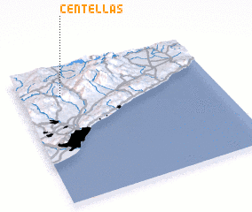 Places with similar names to Centellas, Spain ::
// Santa Alice (BR)
// Santa Elisa (BR)
// Santa Elisa (BR)
// Santa Eloísa (BR)
// Santa Luísa (BR)
// Santa Luísa (BR)
// Santa Luiza (BR)
// Santa Luz (BR)
// Santa Luzia (BR)
// Santa Luzia (BR)
Disclaimer :: Information on this page comes without warranty of any kind |
||
|
Where is Centellas? Elevation and coordinates ::
Latitude (lat): 41°48'0"N Longitude (lon): 2°13'0"E
Elevation (approx.): 545m (map arrows pan, magnifying glasses zoom) |
||
|
Visiting Centellas? Hotel/Accommodation ::
Book a hotel in Centellas Travel Guide ::
Buy a travel guide for Spain rental cars ::
car rental offers GPS waypoint ::
download a GPX waypoint (PoI) of Centellas for your GPS receiver
|
||