|
search place name
|
||
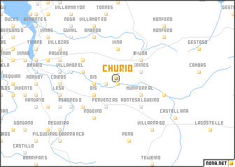
Churío (Galicia, Spain)Churío is a town in the Galicia region of Spain. An overview map of the region around Churío is displayed below.
regional and 3d topo map of Churío, Spain ::
Churío airports ::
The nearest airport is LCG - La Coruna A Coruna, located 24.6 km west of Churío.
Other airports nearby include SCQ - Santiago (47.7 km south west), VGO - Vigo (121.5 km south), BGC - Braganca (191.5 km south east), VRL - Vila Real (221.5 km south), Nearby towns ::
Feás (0.0km north) //
Corujóu (1.3km west) //
Mántaras (1.9km north) //
Ois (2.7km west) //
Muniferral (3.3km south east) //
Verines (3.3km north east) //
Fervenzas (3.9km south) //
Ois (3.3km south west) //
Montesalgueiro (4.6km south east) //
Irijoa (4.6km north east) //
Viña (5.6km north) //
Vigo (4.5km north west) //
Bandoja (5.5km south west) //
Adragonte (5.5km north west) //
Rodeiro (6.2km south west) //
Aranga (5.7km east) //
Villamorel (5.7km west) //
Reboredo (6.6km south west) //
Ambroa (7.9km north) //
Villarraso (8.4km south east) //
Monfero (9.2km north east) //
Güimil (9.2km north west) //
[all distances 'as the bird flies' and approximate] 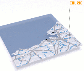 Places with similar names to Churío, Spain ::
Disclaimer :: Information on this page comes without warranty of any kind |
||
|
Where is Churío? Elevation and coordinates ::
Latitude (lat): 43°15'0"N Longitude (lon): 8°5'0"W
Elevation (approx.): 268m (map arrows pan, magnifying glasses zoom) |
||
|
Visiting Churío? Hotel/Accommodation ::
Book a hotel in Churío Travel Guide ::
Buy a travel guide for Spain rental cars ::
car rental offers GPS waypoint ::
download a GPX waypoint (PoI) of Churío for your GPS receiver
|
||