|
search place name
|
||
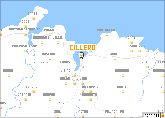
Cillero (Cataluña, Spain)Cillero is a town in the Cataluña region of Spain. An overview map of the region around Cillero is displayed below.
regional and 3d topo map of Cillero, Spain ::
Cillero airports ::
The nearest airport is LCG - La Coruna A Coruna, located 76.9 km south west of Cillero.
Other airports nearby include SCQ - Santiago (110.5 km south west), OVD - Aviles Asturias (125.7 km east), VGO - Vigo (182.3 km south west), BGC - Braganca (215.1 km south), Nearby towns ::
Vivero (1.9km south) //
Faro (2.3km north east) //
Juances (3.3km north east) //
Magazos (3.9km south) //
Covas (3.3km south west) //
Suegos (3.3km north west) //
Vieiro (4.6km south west) //
Vivero (5.6km south) //
Landrove (5.7km south) //
Valle (5.5km north west) //
Galdo (6.2km south west) //
Chavín (7.4km south) //
Jove (5.4km east) //
Mosende (5.4km west) //
Valcarría (7.5km south) //
Portocelo (6.9km north east) //
Valle (7.7km north west) //
[all distances 'as the bird flies' and approximate] 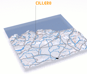 Places with similar names to Cillero, Spain ::
Disclaimer :: Information on this page comes without warranty of any kind |
||
|
Where is Cillero? Elevation and coordinates ::
Latitude (lat): 43°41'0"N Longitude (lon): 7°35'0"W
Elevation (approx.): 135m (map arrows pan, magnifying glasses zoom) |
||
|
Visiting Cillero? Hotel/Accommodation ::
Book a hotel in Cillero Travel Guide ::
Buy a travel guide for Spain rental cars ::
car rental offers GPS waypoint ::
download a GPX waypoint (PoI) of Cillero for your GPS receiver
|
||