|
search place name
|
||
Collía (Asturias, Spain)Collía is a town in the Asturias region of Spain. An overview map of the region around Collía is displayed below.
regional and 3d topo map of Collía, Spain ::

Collía airports ::
The nearest airport is OVD - Aviles Asturias, located 70.8 km west of Collía.
Other airports nearby include SDR - Santander (110.4 km east), VLL - Valladolid (192.0 km south), BGC - Braganca (213.5 km south west), Nearby towns ::
La Vita (0.0km north) //
Bodes (1.3km west) //
San Andrés (1.9km south) //
Castañera (1.9km south) //
Pendás (1.9km south) //
El Collado (1.9km south) //
Bode (2.3km south east) //
Cofiño (2.7km west) //
Hueges (3.7km south) //
Arriondas (3.7km south) //
Alea (3.3km north east) //
Duyos (3.9km north) //
Caravia (3.9km north) //
Coviella (3.9km south) //
Cuadroveña (3.9km south) //
Nevares (4.6km south west) //
Pumarín (5.6km north) //
Prado (5.6km north) //
Romillo (5.6km south) //
Ozanes (5.6km south) //
Villar (4.0km west) //
Sinariega (4.0km east) //
Cayarga (4.0km east) //
Arenas (5.7km south) //
Calabrez (4.4km north east) //
Duesos (5.7km north) //
Arobes (5.7km south) //
El Otero (5.7km south) //
Miyar (4.4km south east) //
[all distances 'as the bird flies' and approximate] 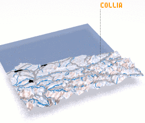 Places with similar names to Collía, Spain ::
Disclaimer :: Information on this page comes without warranty of any kind |
||
|
Where is Collía? Elevation and coordinates ::
Latitude (lat): 43°25'0"N Longitude (lon): 5°11'0"W
Elevation (approx.): 418m (map arrows pan, magnifying glasses zoom) |
||
|
Visiting Collía? Hotel/Accommodation ::
Book a hotel in Collía Travel Guide ::
Buy a travel guide for Spain rental cars ::
car rental offers GPS waypoint ::
download a GPX waypoint (PoI) of Collía for your GPS receiver
|
||