|
search place name
|
||
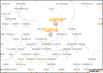
Curtis (Galicia, Spain)Curtis is a town in the Galicia region of Spain. An overview map of the region around Curtis is displayed below.
regional and 3d topo map of Curtis, Spain ::
Curtis airports ::
The nearest airport is LCG - La Coruna A Coruna, located 35.0 km north west of Curtis.
Other airports nearby include SCQ - Santiago (35.2 km south west), VGO - Vigo (105.2 km south west), BGC - Braganca (176.2 km south east), VRL - Vila Real (203.0 km south), Nearby towns ::
Armental (2.3km south west) //
Ciudadela (2.7km east) //
Vilasantar (3.3km south west) //
Présaras (3.9km south) //
Fisteus (3.3km north west) //
Vilariño (3.9km south) //
Curtis (3.9km north) //
Folgoso (5.7km south) //
Teijeiro (6.2km north east) //
Carelle (7.5km south) //
Fojado (5.7km east) //
Andabao (6.9km south west) //
Sobrado (6.9km south east) //
Porta (6.9km south east) //
Mezonzo (6.6km south west) //
Cumbraos (6.6km south east) //
Boimil (8.5km south west) //
Nogueira (8.5km south east) //
Pousada (8.5km south east) //
[all distances 'as the bird flies' and approximate]  Places with similar names to Curtis, Spain ::
Disclaimer :: Information on this page comes without warranty of any kind |
||
|
Where is Curtis? Elevation and coordinates ::
Latitude (lat): 43°5'0"N Longitude (lon): 8°4'0"W
Elevation (approx.): 475m (map arrows pan, magnifying glasses zoom) |
||
|
Visiting Curtis? Hotel/Accommodation ::
Book a hotel in Curtis Travel Guide ::
Buy a travel guide for Spain rental cars ::
car rental offers GPS waypoint ::
download a GPX waypoint (PoI) of Curtis for your GPS receiver
|
||