|
search place name
|
||
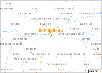
Daimuz Bajo (Andalucía, Spain)Daimuz Bajo is a town in the Andalucía region of Spain. An overview map of the region around Daimuz Bajo is displayed below.
regional and 3d topo map of Daimuz Bajo, Spain ::
Daimuz Bajo airports ::
The nearest airport is GRX - Granada, located 5.1 km east of Daimuz Bajo.
Other airports nearby include GRX - Granada Armilla (19.1 km south east), AGP - Malaga (83.1 km south west), ODB - Cordoba (114.6 km north west), LEI - Almeria (136.1 km east), Nearby towns ::
Láchar (0.0km north) //
Cijuela (1.5km east) //
El Martinete (2.4km north east) //
La Paz (3.0km east) //
Trasmulas (3.0km west) //
Valderrubio (4.0km north) //
Escóznar (4.0km north) //
Romilla (4.4km east) //
Estación de Illora-Lachar (5.8km north) //
Fuente Vaqueros (4.8km north east) //
Chauchina (5.9km east) //
Albenzaíre (5.9km west) //
Chimeneas (7.6km south) //
Ánsola (7.1km north east) //
Zujaira (8.0km north) //
Cortijo Las Villas (8.0km south) //
Casa Nueva (8.6km north east) //
Las Chozas (8.1km south west) //
Cortijada Santa Catalina (9.5km south east) //
[all distances 'as the bird flies' and approximate] 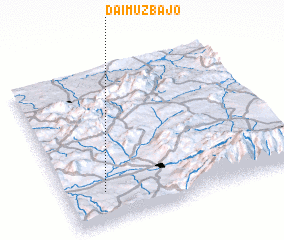 Places with similar names to Daimuz Bajo, Spain :: Disclaimer :: Information on this page comes without warranty of any kind |
||
|
Where is Daimuz Bajo? Elevation and coordinates ::
Latitude (lat): 37°12'0"N Longitude (lon): 3°50'0"W
Elevation (approx.): 527m (map arrows pan, magnifying glasses zoom) |
||
|
Visiting Daimuz Bajo? Hotel/Accommodation ::
Book a hotel in Daimuz Bajo Travel Guide ::
Buy a travel guide for Spain rental cars ::
car rental offers GPS waypoint ::
download a GPX waypoint (PoI) of Daimuz Bajo for your GPS receiver
|
||