|
search place name
|
||
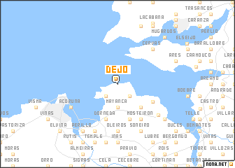
Dejo (Galicia, Spain)Dejo is a town in the Galicia region of Spain. An overview map of the region around Dejo is displayed below.
regional and 3d topo map of Dejo, Spain ::
Dejo airports ::
The nearest airport is LCG - La Coruna A Coruna, located 11.9 km south west of Dejo.
Other airports nearby include SCQ - Santiago (56.5 km south), VGO - Vigo (132.2 km south), BGC - Braganca (216.3 km south east), Nearby towns ::
Serantes (2.3km south west) //
Veigue (2.3km south east) //
Mayanca (3.7km south) //
Mondego (4.6km south east) //
Dorneda (5.7km south) //
Meirás (5.7km south) //
San Andrés de Carnoedo (4.9km south east) //
Mosteirón (6.2km south east) //
Oleiros (7.4km south) //
Cervás (6.9km north east) //
Santa María (6.8km south east) //
A Coruña (6.5km south west) //
Lians (7.9km south) //
Soñeiro (7.9km south) //
Osedo (7.9km south) //
Perillo (8.4km south west) //
Sada (7.7km south east) //
Mugardos (9.2km north east) //
Mehá (9.2km north east) //
[all distances 'as the bird flies' and approximate]  Places with similar names to Dejo, Spain ::
Disclaimer :: Information on this page comes without warranty of any kind |
||
|
Where is Dejo? Elevation and coordinates ::
Latitude (lat): 43°24'0"N Longitude (lon): 8°19'0"W
Elevation (approx.): 76m (map arrows pan, magnifying glasses zoom) |
||
|
Visiting Dejo? Hotel/Accommodation ::
Book a hotel in Dejo Travel Guide ::
Buy a travel guide for Spain rental cars ::
car rental offers GPS waypoint ::
download a GPX waypoint (PoI) of Dejo for your GPS receiver
|
||