|
search place name
|
||
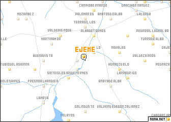
Ejeme (Castilla y León, Spain)Ejeme is a town in the Castilla y León region of Spain. An overview map of the region around Ejeme is displayed below.
regional and 3d topo map of Ejeme, Spain ::
Ejeme airports ::
The nearest airport is SLM - Salamanca, located 20.8 km north of Ejeme.
Other airports nearby include VLL - Valladolid (118.9 km north east), BGC - Braganca (156.0 km north west), MAD - Madrid Barajas (169.1 km east), BJZ - Badajoz Talavera La Real (235.6 km south west), Nearby towns ::
Encinas de Arriba (1.4km west) //
Portillo (2.3km north east) //
Galisancho (2.3km south west) //
Siete Iglesias de Tormes (4.7km south west) //
Alba de Tormes (5.7km north) //
Terradillos (7.4km north) //
Navales (5.9km east) //
Herrezuelo (5.9km east) //
Valdemierque (7.0km north west) //
Anaya de Alba (7.0km south east) //
Martinamor (6.7km north west) //
[all distances 'as the bird flies' and approximate] 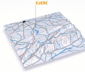 Places with similar names to Ejeme, Spain ::
Disclaimer :: Information on this page comes without warranty of any kind |
||
|
Where is Ejeme? Elevation and coordinates ::
Latitude (lat): 40°46'0"N Longitude (lon): 5°32'0"W
Elevation (approx.): 836m (map arrows pan, magnifying glasses zoom) |
||
|
Visiting Ejeme? Hotel/Accommodation ::
Book a hotel in Ejeme Travel Guide ::
Buy a travel guide for Spain rental cars ::
car rental offers GPS waypoint ::
download a GPX waypoint (PoI) of Ejeme for your GPS receiver
|
||