|
search place name
|
||
El Olivar (Asturias, Spain)El Olivar is a town in the Asturias region of Spain. An overview map of the region around El Olivar is displayed below.
regional and 3d topo map of El Olivar, Spain ::

El Olivar airports ::
The nearest airport is OVD - Aviles Asturias, located 54.2 km west of El Olivar.
Other airports nearby include SDR - Santander (125.5 km east), VLL - Valladolid (205.5 km south), BGC - Braganca (214.5 km south west), Nearby towns ::
Selorio (0.0km north) //
Vega (1.3km east) //
El Villar (1.3km east) //
Bárzana (1.9km south) //
La Vega (1.9km south) //
Espina (1.9km south) //
Villaverde (2.3km south west) //
Sobrayo (2.3km south west) //
Mar (2.7km west) //
Santa Mera (2.7km east) //
Toroyes (3.7km south) //
Gancedo (3.7km south) //
La Atalaya (3.3km north west) //
Tornón (3.3km south west) //
Onón (3.3km south west) //
Pando (3.3km south west) //
Moriyón (3.9km south) //
La Miyar (3.9km south) //
Cueli (3.9km south) //
Castiello de Abajo (3.3km south east) //
Priesca (3.9km south) //
Villar (4.6km south west) //
Miravalles (4.6km south west) //
La Llera (4.6km south east) //
Busto (5.6km south) //
Bayones (5.6km south) //
La Magdalena (5.7km south) //
Paniceres (5.7km south) //
Lué (4.4km south east) //
[all distances 'as the bird flies' and approximate] 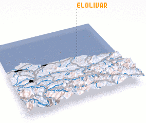 Places with similar names to El Olivar, Spain ::
Disclaimer :: Information on this page comes without warranty of any kind |
||
|
Where is El Olivar? Elevation and coordinates ::
Latitude (lat): 43°31'0"N Longitude (lon): 5°22'0"W
Elevation (approx.): 34m (map arrows pan, magnifying glasses zoom) |
||
|
Visiting El Olivar? Hotel/Accommodation ::
Book a hotel in El Olivar Travel Guide ::
Buy a travel guide for Spain rental cars ::
car rental offers GPS waypoint ::
download a GPX waypoint (PoI) of El Olivar for your GPS receiver
|
||