|
search place name
|
||
Fuentealdea (Castilla y León, Spain)Fuentealdea is a town in the Castilla y León region of Spain. An overview map of the region around Fuentealdea is displayed below.
regional and 3d topo map of Fuentealdea, Spain ::

Fuentealdea airports ::
The nearest airport is VIT - Vitoria, located 136.9 km north of Fuentealdea.
Other airports nearby include ZAZ - Zaragoza Ab (140.9 km east), TOJ - Madrid Torrejon (141.4 km south west), MAD - Madrid Barajas (146.3 km south west), PNA - Pamplona (153.4 km north east), Nearby towns ::
La Revilla de Calatañazor (1.4km east) //
La Barbolla (1.9km south) //
Monasterio (2.8km east) //
Ventosa de Fuentepinilla (4.0km south) //
Nódalo (4.0km north) //
Nafría la Llana (3.3km north west) //
La Muela (3.3km south west) //
Las Fraguas (5.7km north) //
La Seca (6.2km south east) //
Fuentelárbol (6.2km south west) //
Osona (7.4km south) //
La Mallona (7.5km north) //
Osonilla (7.8km south east) //
Aldehuela de Calatañazor (8.5km north west) //
Cascajosa (8.5km south east) //
[all distances 'as the bird flies' and approximate] 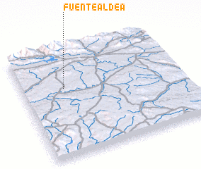 Places with similar names to Fuentealdea, Spain ::
// Fonte Leite (PT)
// Venta Alta (ES)
// Ventillata (PE)
// Vindiolet (FR)
// Vindiolet (FR)
// Vendu Leidi (GW)
Disclaimer :: Information on this page comes without warranty of any kind |
||
|
Where is Fuentealdea? Elevation and coordinates ::
Latitude (lat): 41°39'0"N Longitude (lon): 2°44'0"W
Elevation (approx.): 1003m (map arrows pan, magnifying glasses zoom) |
||
|
Visiting Fuentealdea? Hotel/Accommodation ::
Book a hotel in Fuentealdea Travel Guide ::
Buy a travel guide for Spain rental cars ::
car rental offers GPS waypoint ::
download a GPX waypoint (PoI) of Fuentealdea for your GPS receiver
|
||