|
search place name
|
||
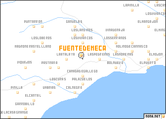
Fuente de Meca (Murcia, Spain)Fuente de Meca is a town in the Murcia region of Spain. An overview map of the region around Fuente de Meca is displayed below.
regional and 3d topo map of Fuente de Meca, Spain ::
Fuente de Meca airports ::
The nearest airport is MJV - Murcia San Javier, located 54.7 km north east of Fuente de Meca.
Other airports nearby include ALC - Alicante (106.2 km north east), LEI - Almeria (120.0 km south west), VLC - Valencia (225.7 km north), ORN - Oran Es Senia (227.9 km south), Nearby towns ::
Leiva (1.9km north) //
Las Pedreras (2.9km east) //
Cañada de Gallego (3.7km south) //
La Atalaya (2.9km west) //
Los Vivancos (3.7km north) //
Palazuelos (5.6km south) //
Los Lardines (5.6km north) //
Barranco de Seca (4.8km south west) //
La Majada (5.8km north) //
La Cañada Honda (5.8km north) //
Bolnuevo (6.2km east) //
Calnegre (7.6km south) //
Mazarrón (6.2km east) //
Pastrana (6.2km west) //
Gañuelas (7.6km north) //
Los Curas (7.1km south west) //
Los Serranos (6.9km north east) //
Viña de Raja (8.1km north east) //
Umbrías (9.5km south west) //
[all distances 'as the bird flies' and approximate] 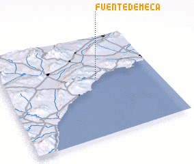 Places with similar names to Fuente de Meca, Spain :: Disclaimer :: Information on this page comes without warranty of any kind |
||
|
Where is Fuente de Meca? Elevation and coordinates ::
Latitude (lat): 37°35'0"N Longitude (lon): 1°23'0"W
Elevation (approx.): 181m (map arrows pan, magnifying glasses zoom) |
||
|
Visiting Fuente de Meca? Hotel/Accommodation ::
Book a hotel in Fuente de Meca Travel Guide ::
Buy a travel guide for Spain rental cars ::
car rental offers GPS waypoint ::
download a GPX waypoint (PoI) of Fuente de Meca for your GPS receiver
|
||